NATL GIS map (19 layers)
To use NATL's GIS map you must have its component files and access to a computer that has the ArcGIS program. The required files are available to download here in zipped compressed format (~17MB).
In the summer of 2008, NATL Graduate Teaching Assistant Jason Martin used ArcGIS to produce 14 layers of a digital, multi-layered GIS map of NATL. In 2008-2010, Robert Guggenheim modified nine of the original layers, added new ones, and reorganized the layers to reduce the number of principal layers to 18. With the aid of a sub-meter GPS device, he increased the accuracy of the mapping of trails, boundaries, and water features. Of fundamental importance, he made the position of the grid points in the NATL Grid System layer agree with the position of the "on the ground" grid points--as surveyed and marked with iron stakes by the Student Geomatics Association (details). Guggnheim then used the upgraded GIS map to produce a variety of maps for general use, including GIS-based grid maps for NATL, NATL-west, and NATL-east. In 2020 Brittany Evans added san additional invasive plants layer increasing the number of principle layers to 19.
Currently there are these 19 layers:
1. Frame
2. NATL Boundaries
3. Trails
4. NATL Grid System
5. Trees (Guggenheim 2008-2010)
6. Water Features
7. Land Use
8. Public/Restricted Access
9. LIDAR Elevation Contours
10. 100-year Flood Plain (2000)
11. Soils of NATL-west (Collins 2000)
12. Soils (STATSGO)
13. Drainage Basins
14. Aerial Photos
15. UF Roads
16. Buildings
17. Sound Levels (Pasch 2009)
18. Invasives (Celis & Pieterson 2009)
19. Invasives (Evans 2020)
These layers can be displayed singly or in any combination. Examples of the displays that can be produced and the layers used to produce them are shown below.
 |
2000 Aerial Photo Layer 15. (Dotted green lines are NATL boundaries as added to the photo by Facilities Planning and Construction.) |
 |
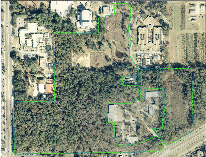
2006 Aerial Photo Layer 16. (Dotted green lines are NATL boundaries as added to the photo by Facilities Planning and Construction.) |
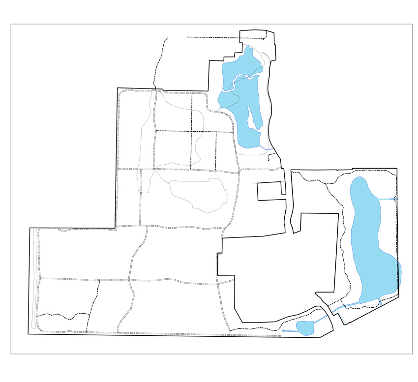 |
Trails and water features Layers 1+2+3+6. |
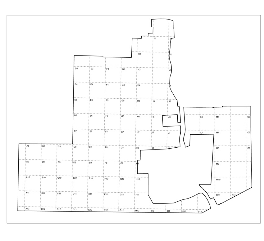 |
50-meter grid Layers 1+2+4. |
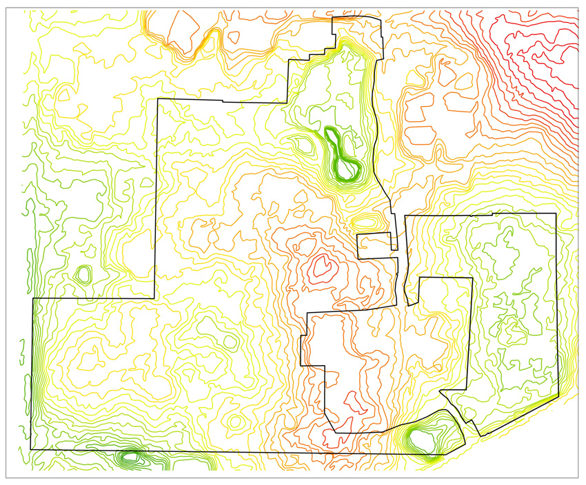 |
LIDAR Elevation Contours Layers 1+2+9. |