Principal Improvements to NATL (1994-date)
Descriptive List of Principal Improvements to NATL with Links.
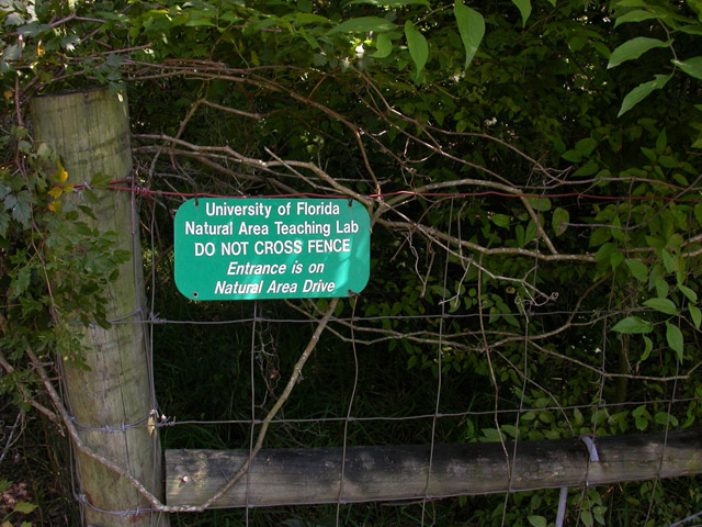
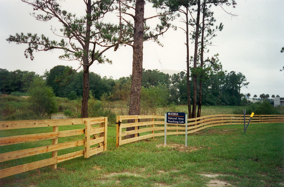
Jump to Improvement: No. 9 (1998), No. 18 (2005), No. 27 (2009), No. 36 (2011), No. 45 (2013).
Want to help improve NATL? We accept financial support and donations of equipment.
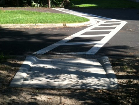 |
52. Cultural Plaza ADA accessibility improvements (2014) In October, the curb was dropped and a crosswalk was painted along the path between the Cultural Plaza and NATL. Previously, it was not possible for people in wheelchairs to easily access NATL using this path. A second part of this improvement, the construction of a boardwalk from the sidewalk near the museum to the newly painted crosswalk, is pending. This boardwalk will decrease the steep slope that visitors encounter when following the path to NATL from the Cultural Plaza. |
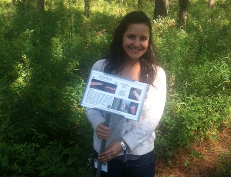 |
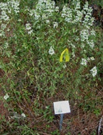
51. Lepidoptera biology photosigns (2014) Minigrant recipient Elena Ortiz developed twenty 11x7 inch photosigns concentrating on native moths and butterflies. Each sign focuses on an individual butterfly or moth and its host plant or compare two similar lepidopteran species. The life cycle and host plants for each species are outlined on the signs. Elena’s Lepidoptera biology signs were installed in NATL in October. |
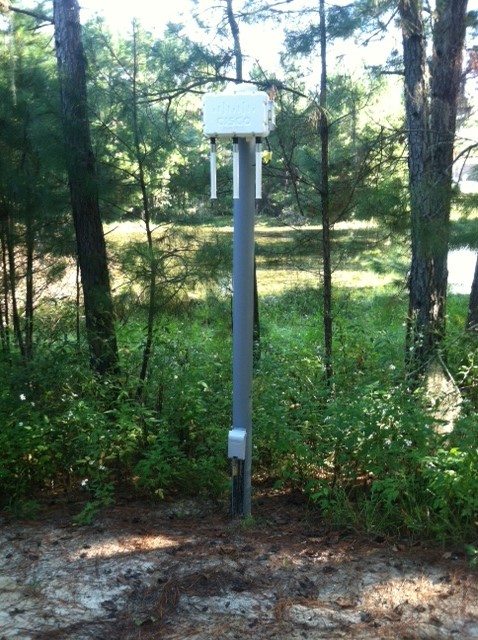 |
50. WiFi (2014) In the fall of 2013, NATL was awarded a grant from IFAS Technology Fee, as announced in this article. Installation of WiFi stations began in late fall and they became active in June 2014. A total of five stations were placed in the Public Area, where they boost UF’s WiFi network in the Public Area from Main Trail north to NATL’s corral fence. At the academic pavilion and the base of each station are electrical outlets for special uses. We hope that the utilization of this grant will one day allow us to lead virtual tours of NATL and to initiate other projects, such as the installation of live feed wildlife cameras. |
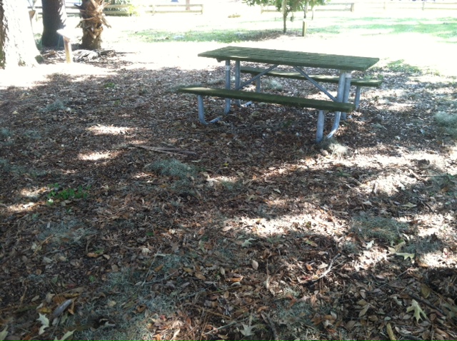 |
49. Mulching of Natural Area Park (2014) In March, PPD delivered two loads of mulch to Natural Area Park. The initial load was spread around some of the picnic tables by super volunteers Thomas Walker and Ken Prestwich. The second load was brought to increase the thickness of the layer and expand the mulched region to all picnic tables. It was spread by graduate TA Amanda Abel and undergraduate TA Ethan Carter. |
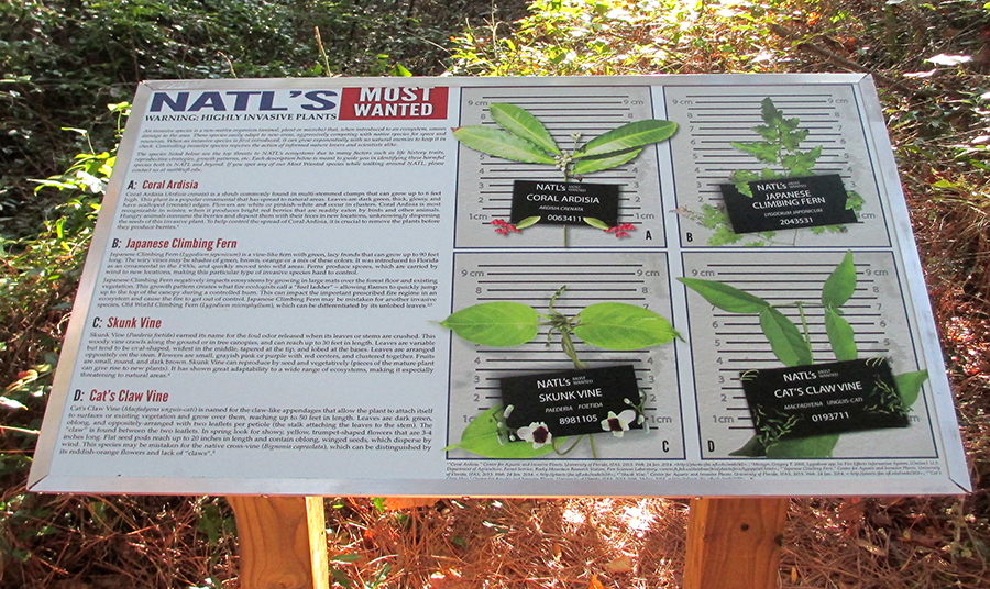 |
48. NATL’s most wanted sign & brochure (2014) Development of a 3×2 ft sign focusing on four important invasive plant species started in the spring of 2014. This project aimed to educate the public on invasive species and an accompanying brochure was created to aid in identification of these plants. The sign was designed by Chris Johns and brochure was created by Nicole Casuso. It was decided that they should incorporate plants that NATL seeks to control and ranks as highest priority invasive species. |
 |
47. Top 50 species checklist (2014) In February, booklets challenging visitors to find 50 species were made available to the public at the academic kiosk. Fun for all ages, these booklets test your knowledge on species identification of flora and fauna found within NATL. A total of 50 species are listed in the following categories: trees and shrubs, forbs and grasses, vines, insects, amphibians, reptiles, birds and mammals. As visitors tour NATL they check off species that they see. Inexperienced viewers can find photosigns for many of the species along the self-guided nature trails. Images and descriptive text for each species on the Top 50 Checklist are available on our website, you can also print your own copies along with folding directions. |
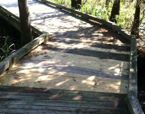 |
46. Maintenance of SEEP boardwalk (2014) In January, the Wetlands Club replaced twenty-six boards along the boardwalk that were starting to degrade. Heavy rains in July caused the water level in the SEEP to slowly increase until the entire boardwalk was submerged. When the water level subsided days later, it was noted that several boards were compromised. Between August and September, the Wetlands Club cut and replaced at least fifteen more boards that had become degraded from being submerged. |
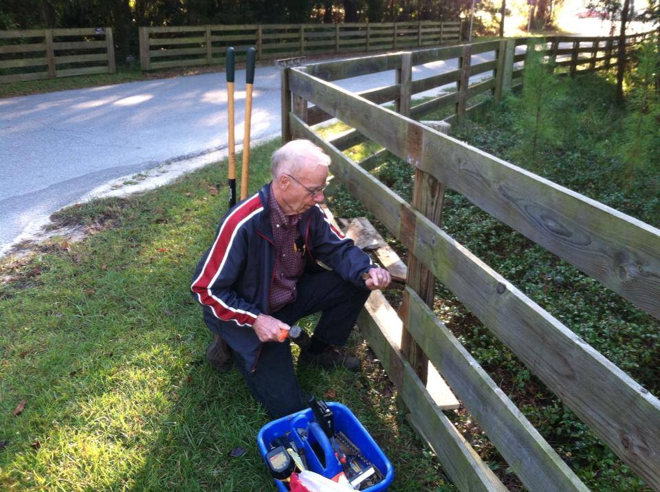 |
45. Corral fence maintenance (2013) Several boards along the corral fence were severely bowed or broken. These boards, as well as an area where the fence was leaning, were fixed by super volunteer Thomas Walker and undergraduate TA Ethan Carter. |
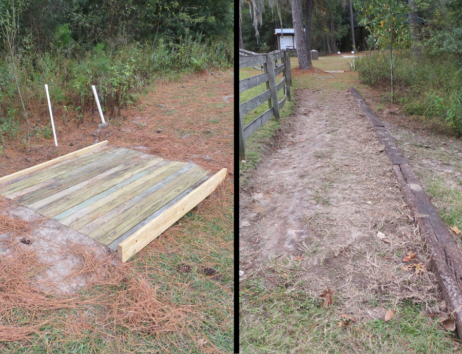 |
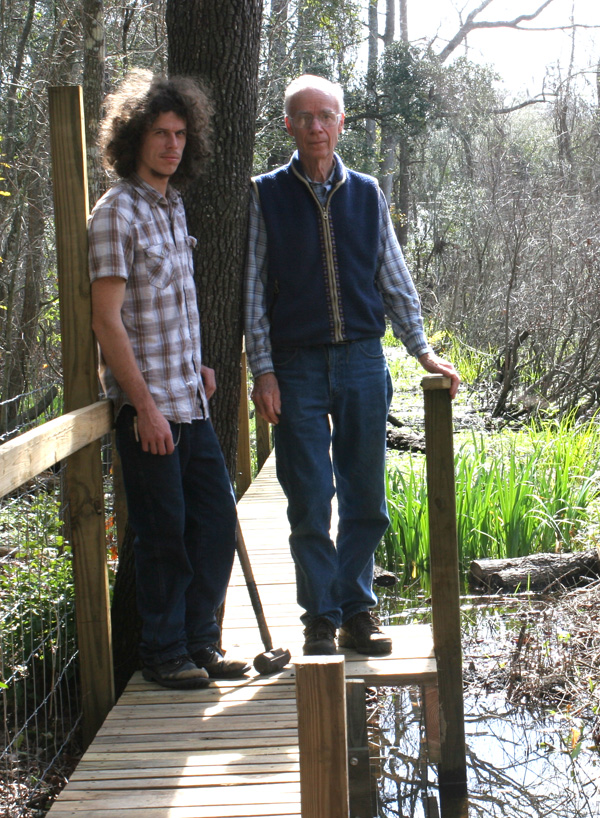
44. SEEP trail wheelchair accessibility improvements (2013) In the past one portion of the SEEP nature trail sloped so steeply that wheelchair users feared they would turn over. In another portion of the trail, a swale also made wheelchair accessibility difficult. On October 20, 2013, the Alpha Gamma Rho fraternity, helped by Tom Walker, leveled the trail by placing railroad ties downslope and cutting soil from upslope (photo at right)and using it to fill behind the ties. They also built a small bridge across the swale (photo at left). More information about the improvements can be found here. |
 |
43. New rain gauge installed (2013) In March 2013, Dr. Mark Clark donated a data-logging rain gauge which records rain with a tipping bucket rainfall collector. This new gauge gives digital readings of water level and temperature, and can be found on the East Trail near the SEEP, beside the original milk can rain gauge. |
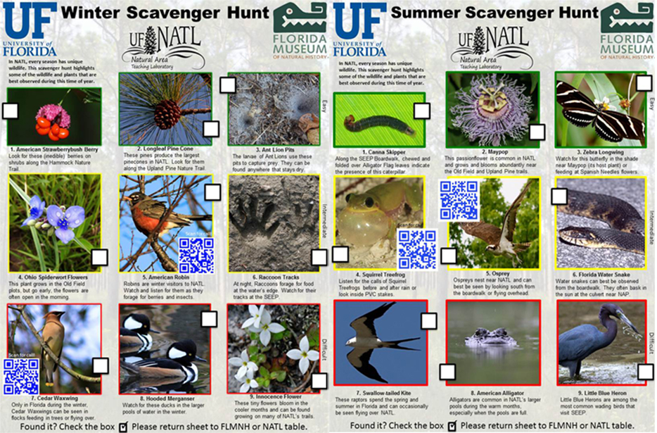 |
42. Scavenger hunts (2013) In February, visitors of NATL were first offered the opportunity to participate in a scavenger hunt geared towards various species of flora and fauna. There is a scavenger hunt for each of the four seasons: spring, summer, fall and winter. The scavenger hunts were laminated so that they could be completed with a dry erase marker, cleaned and reused. They are available at the front desk of the Florida Museum of Natural History, where they are to be returned after each use. |
 |
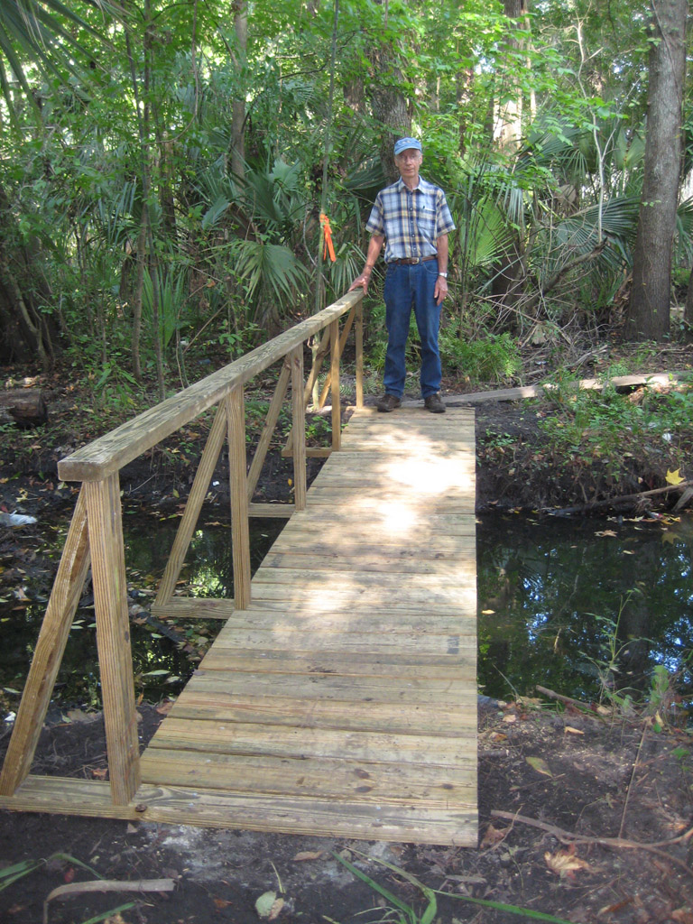
41. NATL East kiosk sign (2013) In early February 2013, the NATL Operations Commitee began planning for a new poster on NATL rules and uses to fill the previously empty kiosk located at the edge of NATL East, along Surge Area Drive. The poster was designed by Chris Johns and Amanda Abel. |
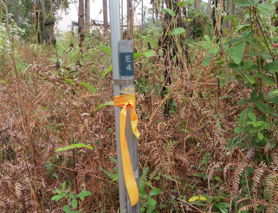 |
40. Verification and upgrade of 50x50m gridpoints (2012) During the fall of 2012, Amanda Abel and Ethan Carter, helped by Tom Walker, located 83 surveyed gridpoints in NATL-west and 12 surveyed gridpoints in NATL-east. When no pin was found within or near the gridstake, a proxy pin was installed. More information about the verification and upgrade can be found here. |
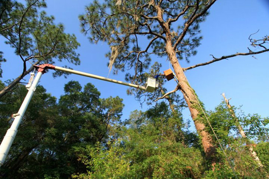 |
39. Barn Owl nest box (2012) On March 22, 2012, Lary Reeves, with the help of Charlotte Loomis and PPD, installed a Barn Owl nest box at the start of the old field nature trail. The Barn Owl, though not threatened here, is the least common owl in Florida. They require large cavities in trees or man-made structures (hence their name) for building a nest and they hunt at night in open grassy fields with large trees. Barn Owls are known to readily utilize artificial nest boxes, and the old field ecosystem in NATL will provide the ideal habitat for raising a brood. [More Information] |
 |
38. Bike racks (2012) During the first week of 2012, NATL recieved a bike rack of unknown origins at the Natural Area Park (NAP) entrance near the SEEP boardwalk. Another bike rack was procured by Tom Walker from PPD and is located at the NATL main entrance near the pavilion. These bike racks allow visitors to visit NATL without worrying about parking restrictions and also solved the problem of people locking their bicycles to the fence or nearby trees. |
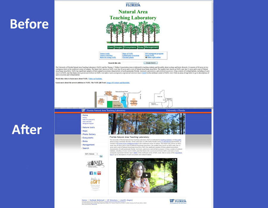 |
37. NATL website makeover (2012) In the summer of 2012 Tom Barnash worked with the OpComm to update the NATL website that was originally developed by Tom Walker and Phoebe Wilson in 1994-1998. The new site went live on September 20th of 2012. |
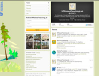 |
36. NATL joins Twitter (2011) The NATL Twitter account (@UFNATL) was created in September 2011 and is maintained by Dr. Jennifer Gillett-Kaufman. As of October 2014, NATL's Twitter account has 633 Followers. |
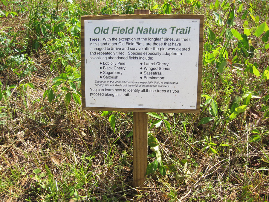 |
35. Printed guides to nature trails replaced (2011) When NATL's upland nature trails were completed in 2007, a bin on each kiosk offered a printed trail guide keyed to numbered stakes along the trails. Later both advanced and basic trail guides were offered. These guides have now been made obsolete by interpretive signs along the trails. [However, printed academic guides, for those with academic interests, are now offered on the Upland Pine Trail and are in preparation for the Old Field and Hammock Trails.] |
 |
34. NATL joins Facebook (2010) On November 18, 2010 NATL joined Facebook, posting pictures and information about volunteer opportunities, changes to the nature trails and interesting flora and fauna. The NATL OpComm is responsible for Facebook updates, with posts being made every day of the week. As of October 2014, NATL's Facebook page has 736 Likes. |
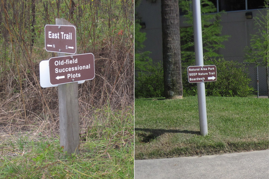 |
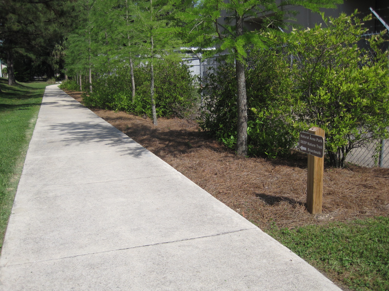
33. New wayfinding signs (2010) NATL signs were originally green-and-white, reflective, parking-lot-type signs (see enhancements Nos. 6 and 17 above). These were swapped out for brown-and-white, non-reflective signs, and new wayfinding signs were designed and installed to guide persons from a Cultural Plaza crosswalk to the sidewalk leading to Natural Area Park, the SEEP Nature Trail, and its boardwalk. |
 |
32. First people-counter put into service (2010) As the numbers using NATL's public area increased, it became important to have evidence of the increase and to quantify its extent. The first counter (Trailmaster) was installed at the Cultural Plaza entrance to NATL in July 2010 and initial counts have ranged from 1659 (in July when FLMNH classes were using NATL) to 647 (in December, when the weather turned cold and UF closed for the holiday break). Current Trailmaster data is available here. |
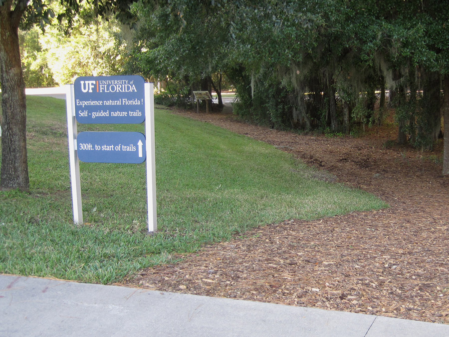 |
31. Trail from Cultural Plaza to NATL (2010) Prior to 2010, those walking from the Cultural Plaza to the trailheads of NATL's upland nature trails had to take an unmarked path down a sloping lawn between Powell Hall and the Phillip Center. UF's Physical Plant remedied the problem by constructing a mulched trail across the lawn and a small bridge across a draw where the lawn ended. The NATL advisory committee provided wayfinding signs and a 3x2ft introductory sign immediately before the bridge. |
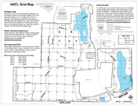 |
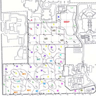
30. GPS/GIS-based maps of NATL (2010) Aided by a sub-meter GPS device, Robert Guggenheim substantially improved the accuracy of the GIS layers for NATL's boundaries, trails, grid system, and water features. He then developed more accurate and more detailed maps of NATL (click on thumbnail at left), NATL-west, and NATL-east. [More information] |
 |
29. Photosigns for nature trails (2009) NATL Graduate Teaching Assistant Natalie Hooton developed this effective, flexible means of helping nature trail users learn to identify the wildflowers and other vascular plants they encounter. In the picture at left, the sign holder is at center bottom. Click on it to see the sign. [More information] |
 |
28. Pre-NATL pines mapped and measured (2009) Robert Guggenheim (assisted by GPS and T. J. Walker) developed a GIS layer that stores the species, DBH, position, and other noteworthy data for pines judged to have been present when NATL began in 1994. This layer is used to produce maps that show the position, diameter, and identifying number of each pine. [More information] |
 |
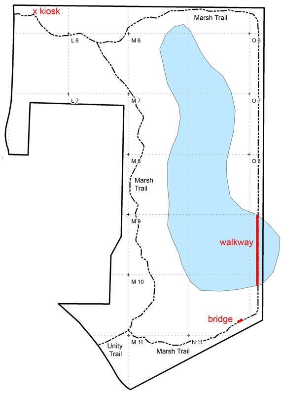
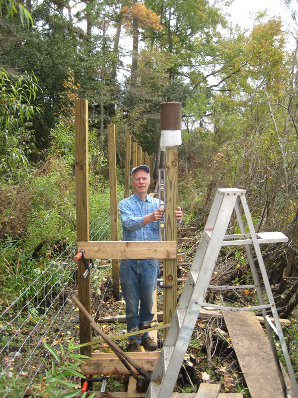
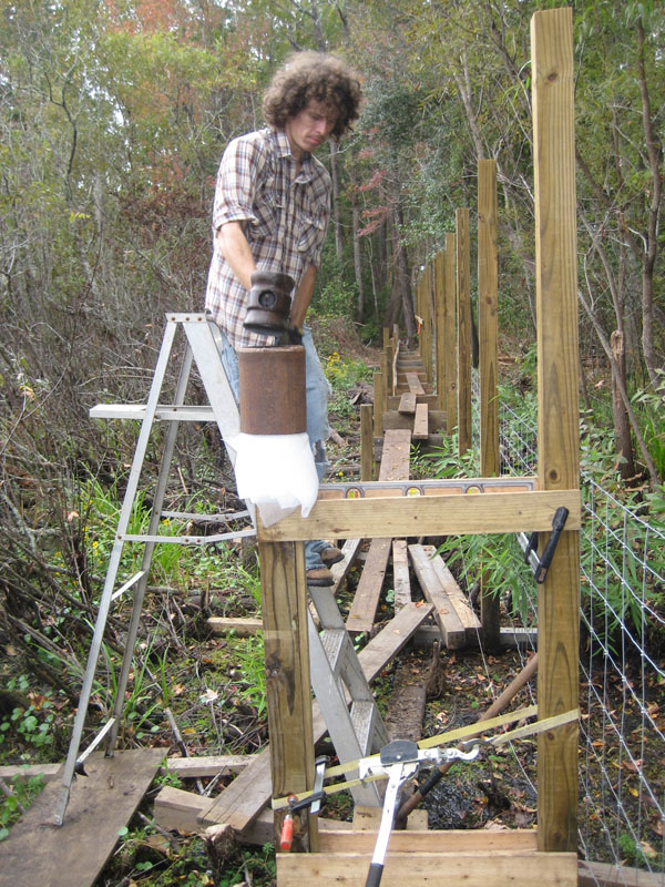
27. "Green" cross-marsh walkway (2009) T. J. Walker and Robert Guggenheim completed a 217-foot walkway across an arm of the Central Marsh, thereby closing the loop of the Marsh Trail (done!). For some pilings and for all stringers and decking, they used lumber salvaged from the building of the SEEP boardwalk and the dismantling of corral fences. This saved $1096 and reduced the total costs of materials to $1004. [More information: map, plan, as-built data, costs of materials and salvage savings] |
 |
26. NATL-east improvements (2008) The Student Geomatics Association extended NATL's 50-meter grid into NATL-east, and T. J. Walker made a grid-based photographic record of its vegetation. At the north entrance to NATL-east a kiosk was installed, and across a stormwater washout, a foot bridge was built. Construction began on a walkway across an arm of the Central Marsh that extends across NATL's boundary. With the GIS map as a foundation, NATL's grid map was expanded to include NATL-east. |
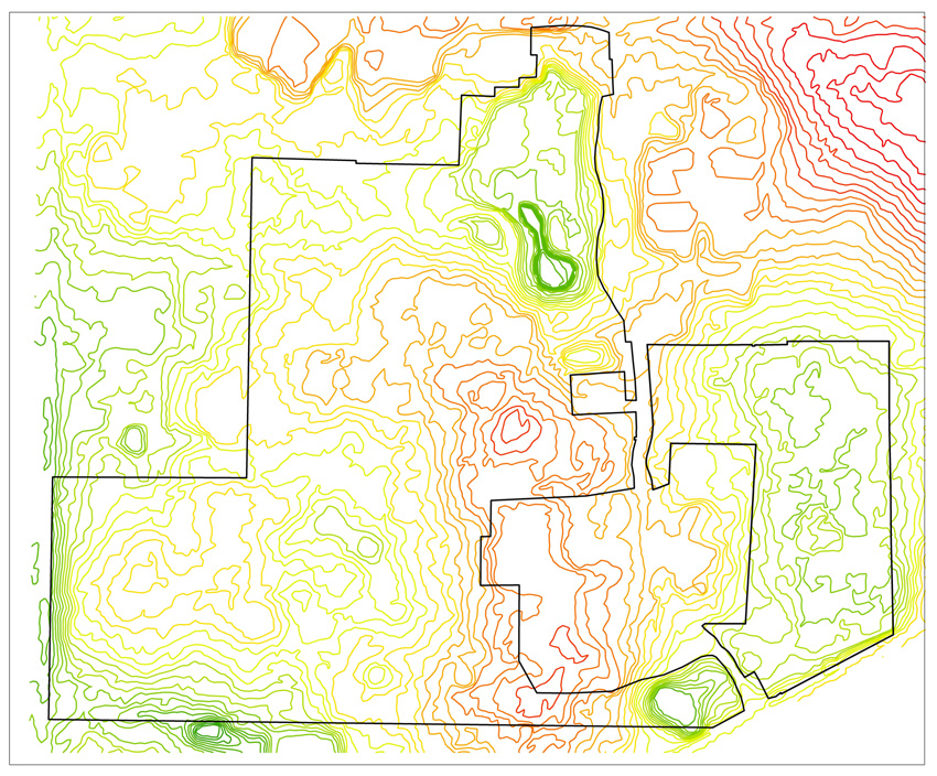 |
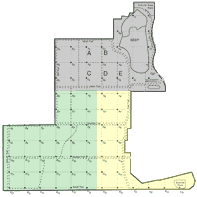
25. GIS map of NATL (2008) NATL Graduate Teaching Assistant Jason Martin used ArcGIS to produce a 19-layer digital map of NATL. (The map at left, showing LIDAR elevation contours, displays three of these layers.) [More information] |
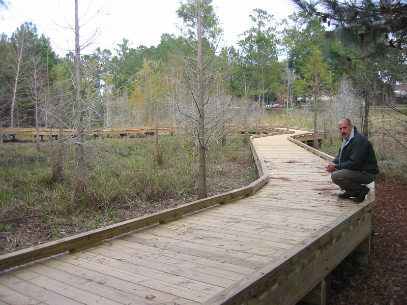 |
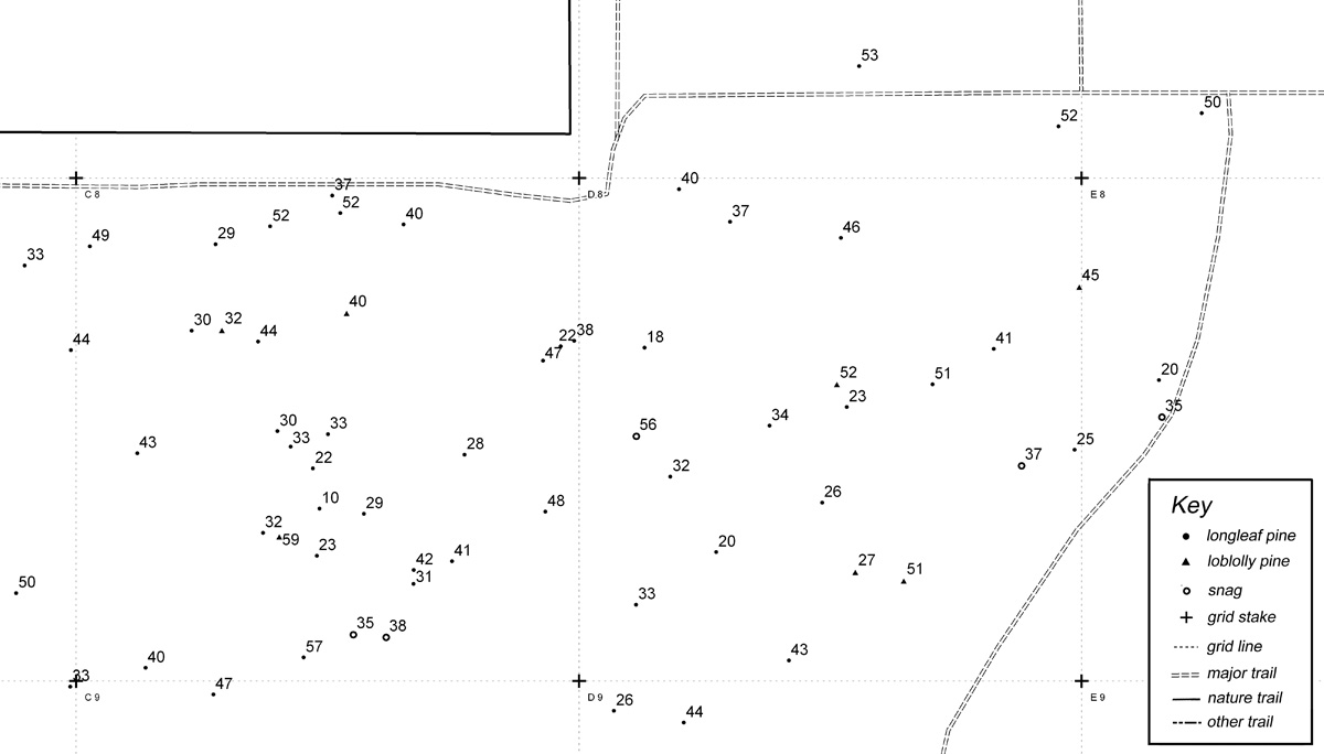
24. Wetland nature trail with boardwalk (2008) The SEEP Nature Trail includes a 500ft boardwalk that allows trail users to keep their feet dry as they learn how a conventional stormwater retention pond was ecologically engineered to improve its water storage and treatment functions and to be more attractive to wildlife and to human viewers. Mark Clark (on right) has headed the development of SEEP from its inception in 1995. |
 |
23. Upland nature trails (2007) The trails for the three upland ecosystems--hammock, old-field succession, and upland pine--were completed in 2007. At the start of each trail is a kiosk with an explanatory poster and a supply of trail guides. A fourth kiosk, where persons enter NATL from the Cultural Plaza, introduces the public to NATL and its nature trails. Tom Walker (on right) headed the development of these trails. |
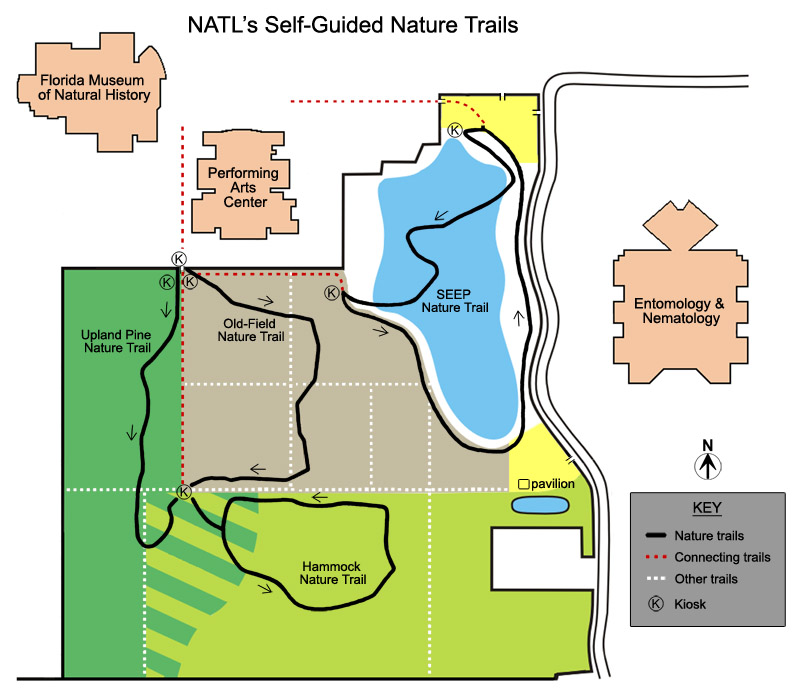 |
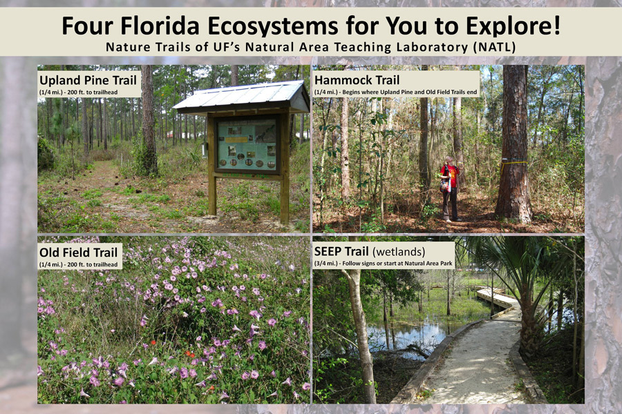
22. System of self-guided nature trails (2006) The 1993 proposal for a "Campus Natural Area and Outdoor Teaching Laboratory," which led to NATL, included a system of nature trails through the area's principal ecosystems. In 2006, NAAC was awarded money for four self-guided nature trails from the Environmental Stewardship Project of the Capital Improvement Trust Fund. For details, see NATL's Self-Guidied Nature Trails. |
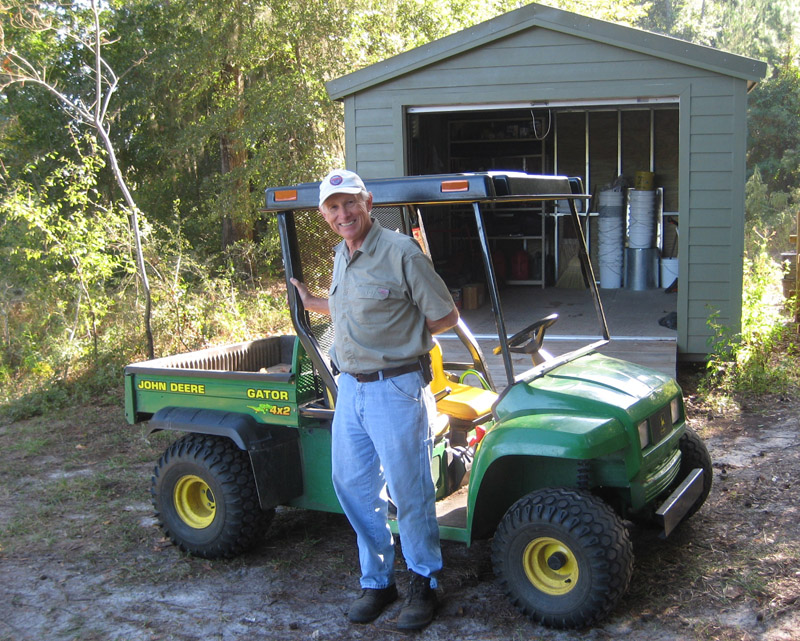 |
21. NATL acquires utility vehicle (2006) Professor Don Dickson (center), a long-time member of NATL's Natural Area Advisory Committee, donated this John Deere Gator 4x2 utility vehicle for use in developing and maintaining NATL. |
 |
20. Storage building erected (2006) NAAC was awarded money for this building from the Environmental Stewardship Project of the Capital Improvement Trust Fund (CITF). CITF is generated from student fees, and student government must approve the allocation of its funds. The storage building contains NATL's utility vehicle and other equipment and supplies. |
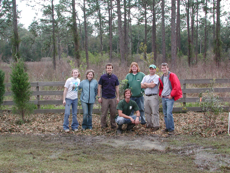 |
19. NATL Graduate Teaching Assistant (GTA) hired (2005) Kevin Ratkus (kneeling) was NATL's first GTA, serving through 2007, at which time the position was made permanent. One of the GTA's many duties is to organize events in which volunteers work to improve NATL. Here Kevin is with six volunteers who worked in the rain (and longer than agreed) to finish planting shrubs and trees that screen NATL's North Trail from the Phillips Center's rear parking lot. [The fence was later moved to the north of the planting.] |
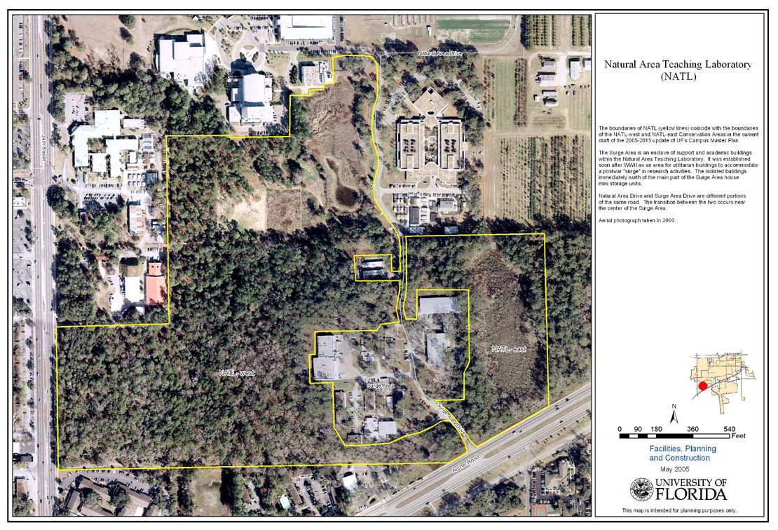 |
18. Surge Area wetland becomes NATL-east (2005) Eleven acres of mostly wetlands east of Natural Area/Surge Area Drive has a biota and physical features importantly different from those of the original NATL (now NATL-west). LVL approved the concept of a NATL-east at its July 2004 meeting (PowerPoint presentation), and the administration gave final approval to the addition in the spring of 2005. |
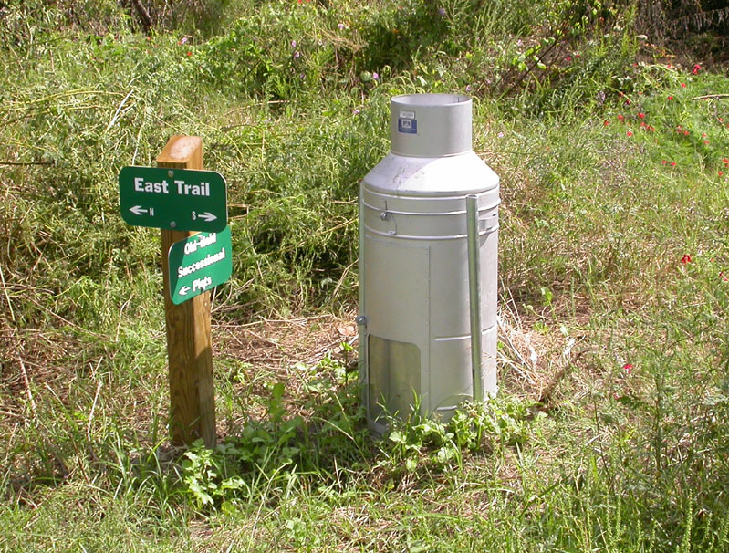 |
17. Rain gauge installed (2004) In July 2004, a rain gauge donated by the Department of Entomology and Nematology was placed on the west edge of SEEP at the junction of East and Old-Field Trails. Gainesville rains are far from spatially uniform. Data from the NATL rain gauge helps estimate NATL soil moisture, which is important in planning controlled burns and when to water recent transplants. Rainfall amounts recorded for NATL's milk can rain gauge are at NATLrain_milkcan.xls. |
 |
16. Proposed extension of SW 24th Avenue resolved (2004) In January 2003, the UF administration announced that UF would provide right-of-way from the southern edge of NATL for a four-lane, eastward extension of SW 24th Avenue. The Natural Area Advisory Committee worked to reverse this decision and maintained a web site to document the issues. In May 2004, President Bernie Machen announced that the University was withdrawing its offer to donate the right-of-way. |
 |
15. Natural Area Park (2003) As described and illustrated elsewhere, Natural Area Park is an interface between the Cultural Complex and NATL. It provides a shady respite for the public and a place for the K-12 groups visiting the Florida Museum of Natural History to eat their picnic lunches. A kiosk describes NATL and its Stormwater Ecological Enhancement Project and invites users of the park to explore them. |
 |
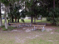
14. Academic pavilion (2002) This all-steel, 32 x 27 ft pavilion provides shelter, seating, and work tables for classes and individuals who use NATL. Its six tables accommodate as many as 38 students, including two in wheel chairs. It was funded by the Provost and the CALS Dean and erected with the help of IFAS Facilities Operations. |
 |
13. Grid-based record of soils (2000) Personnel in the Soil and Water Science Department, led by Dr. Mary E. Collins, surveyed and mapped NATL soils. |
 |
12. Blue-light emergency phone installed (2000) This emergency phone at NATL's academic entrance was recommended in a University Police Department security survey and funded by the UF Administration. |
 |
11. Berm along 34th Street (1999) This is the northern half of a 670 ft long, 7 ft high earthen berm constructed to reduce the impact of 34th Street traffic along the eastern edge of the southern block of NATL's upland pine. The berm removes visual distractions and attenuates traffic noise to some extent. Unfortunately it also reduces the area that can be maintained as upland pine. |
 |
10. Kiosk for academic entrance (1998) This kiosk, along with one that was later installed in Natural Area Park, was constructed in the shop at the Florida Museum of Natural History and partially funded from a grant by the Division of Cultural Affairs, Florida Department of State. It replaced a temporary display board. |
 |
9. Retention basin re-contoured for SEEP (1998) The retention basin in the northeast corner of NATL is the site of the Stormwater Ecological Enhancement Project (SEEP). This project of the Wetlands Club required that the basin be re-contoured to establish a variety of fresh water habitats, including a water-treatment forebay, a cypress swamp, a tree island, herbaceous marshes, and permanent pools of open water. |
  |
8. Grid-based photographic record of vegetation (1997, 2007-08) In January 1997, a photographic record was made of NATL by taking pictures to the north, east, south, and west at each grid intersection. This was repeated for NATL-west in 2007 and NATL-east in 2008. |
 |
7. Old-field plots established and maintained (1997-date) As illustrated and described elsewhere, five plots have been established and are being managed to permanently display varied stages of old-field succession. |
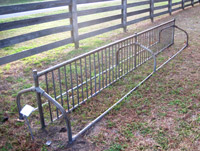
 |
6. South and east boundary fences (1997) Prior to the construction of this fence, NATL's south boundary was open to vagrants who entered via a path from the Bennigan's parking lot. During the routing of the fence, NATL's boundary with the Surge Area was refined by UF's Land Use and Facility Planning Committee to include in NATL the retention pond that serves the Surge Area's mini-warehouses. |
 |
5. 50-meter grid surveyed and staked (1996-date) In 1995-1996, the Student Geomatics Association (SGA) surveyed a grid system for NATL. Surveyed points were at 100-meter intervals, but stakes were installed at 50-meter intervals; three years later SGA volunteers resurveyed the grid and placed metal markers at 50-meter intervals to mark all grid intersections. In 2006-07, SGA expanded the grid to include 14 acres added to NATL in 2005. The geographic coordinates of NATL gridpoints are at http:/natl.ifas.ufl.edu/GPSgridpts.xls. These were updated in 2010. |
 |
4. Surveys of biota (1995-date) Higher plants, vertebrates, and many groups of invertebrates that occur in NATL have been surveyed and the results posted. |
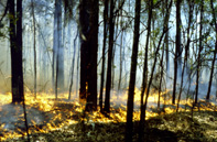 |
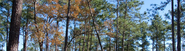
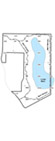
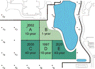
3. Upland pine ecosystem restored (1995-date) As illustrated and described elsewhere, NATL's upland pine ecosystem was choked with laurel oaks in 1995. By 2004, after six prescribed burns and the cutting or killing of hundreds of the invading oaks, the ecosystem was once more hospitable to the germination of the seeds of longleaf pines and the growth of their seedlings. |
 |
2. Corral fence and sign at east entrance (1995) This fence and sign were the first improvements sought and obtained by NAAC. The fence was funded by College of Agriculture Dean Larry Connor and the sign was provided by the Physical Plant Division. |
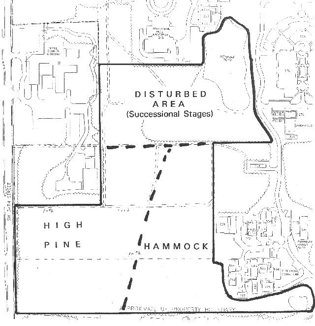 |
1. Long-term management plan (1994-date) When the Natural Area Advisory Committee (NAAC) began its work in September 1994 it adopted the land-use plan that was in the 1993 proposal for a "Campus Natural Area and Outdoor Teaching Laboratory," approved by UF's Land Use and Facilities Planning Committee in May 1994. The current map and plan are refinements of the original ones. |
Descriptive List of Principal Improvements to NATL
52. Cultural Plaza ADA accessibilty improvements (2014)
51. Lepidoptera biology photosigns (2014)
50. WiFi (2014)
49. Mulching of Natural Area Park (2014)
48. NATL’s most wanted sign & brochure (2014)
47. Top 50 species checklist (2014)
46. Maintenance of SEEP boardwalk (2014)
45. Corral fence maintenance (2013)
44. SEEP trail wheelchair accessibility improvements (2013)
43.New rain gauge installed (2013)
42. Scavenger hunts (2013)
41. NATL East kiosk sign (2013)
40. Verification and upgrade of 50x50m gridpoints (2012)
39. Barn Owl nest box (2012)
38. Bike racks (2012)
37. NATL website makeover (2012)
36. NATL joins Twitter (2011)
35. Printed guides to nature trails replaced (2011)
34. NATL joins Facebook (2010)
33. New wayfinding signs (2010)
32. First people-counter put into service (2010)
31. Trail from Cultural Plaza to NATL (2010)
30. GPS/GIS-based maps of NATL (2010)
29. Photosigns for nature trails (2009)
28. Pre-NATL pines mapped and measured (2009)
27. "Green" cross-marsh walkway (2009)
26. NATL-east improvements (2008)
25. GIS map of NATL (2008)
24. Wetland nature trail with boardwalk (2008)
23. Upland nature trails (2007)
22. System of self-guided nature trails (2006)
21. NATL acquires utility vehicle (2006)
20. Storage building erected (2006)
19. NATL Graduate Teaching Assistant (GTA) hired (2005)
18. Surge Area wetland becomes NATL-east (2005)
17. Rain gauge installed (2004)
16. Proposed extension of SW 24th Avenue resolved (2004)
15. Natural Area Park (2003)
14. Academic pavilion (2002)
13. Grid-based record of soils (2000)
12. Blue-light emergency phone installed (2000)
11. Berm along 34th Street (1999)
10. Kiosk for academic entrance (1998)
9. Retention basin re-contoured for SEEP (1998)
8. Grid-based photographic record of vegetation (1997, 2007-08)
7. Old-field plots established and maintained (1997-date)
6. South and east boundary fences (1997)
5. 50-meter grid surveyed and staked (1996-date)
4. Surveys of biota (1995-date)
3. Upland pine ecosystem restored (1995-date)
2. Corral fence and sign at east entrance (1995)
1. Long-term management plan (1994-date)
