History and Starting Dates of Old-Field Plots
Pre-NATL history
Early aerial photographs of the land that is now NATL suggest that it was fenced and grazed prior to becoming part of UF's Experiment Station Farm in 1944. The area of the present old-field plots had some large longleaf pines and lots of scrubby turkey oaks. What is known of its history from 1950 until 1990 is reconstructed from an interview in which the retired supervisor of the Experiment Station Farm interprets a series of aerial photographs. Of special importance is that beginning in about 1956 and continuing through 1974, large amounts of clay excavated from the Shands Health Center site were spread on what is now old-field Plots B, C, D, and E.
-
Starts, re-starts, and planned re-starts
In the two columns below are the years and months of the starts and re-starts of the five old-field plots, followed [in brackets] by the current plans for future re-starts.
Plot A (10-year) Plot Bne (1-3 years) 2002 (Mar) 2001 (Nov) 2012 (Dec) 2003 (Apr) [2021 (Aug begin preparation)] 2005 (Jan) [2022 (Nov/Dec re-start)] 2006 (Nov) 2009 (Sep) Plot D (10-year) 2011 (Nov) 1997 (Feb) 2013 (Oct) 2007 (Dec) 2014 (Oct) [2016 (Aug begin preparation)] [2016 (Spr)] [2017 (Nov/Dec re-start)] [2017 (Fall)] [2019 (Spr)] Plot C (40-year) 2000 (Nov) Plot Bsw (1-3 years) [2035 (begin preparation)] 2001 (Nov) [2040 (re-start)] 2003 (Apr) 2005 (Jan) Plot E (40-year) 2008 (Oct) [2015 (begin preparation)] 2010 (Nov) [2020 (re-start)] 2012 (Sep) 2015 (Feb) [2016 (Fall)] [2018 (Spr)] [2019 (Fall)] -
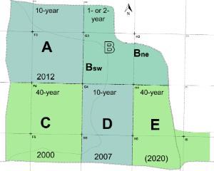
Defining the Plots
1993 Map1993 Map
In the Original Proposal for a Campus Natural Area and Outdoor Teaching Laboratory, the entire area north of the Main Trail was to be managed to permanently display a diversity of stages of old-field succession.1995 Map 1995 Map
The Natural Area Advisory Committee [NAAC] decided that the western part of the originally designated area should be restored as upland pine and that a corridor from the retention basin to the hammock ecosystem should be allowed to permanently revert to hammock to facilitate wildlife movement between the two habitats.1997 Map1997 Map
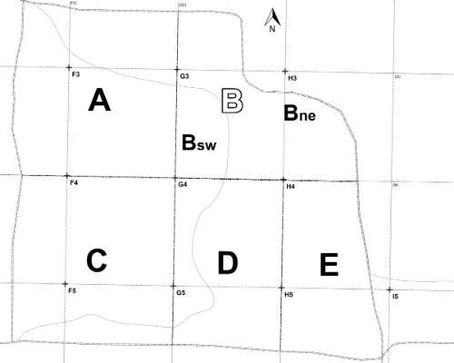
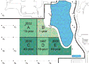
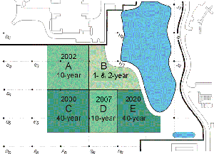
In October 1997, NAAC voted to further modify the plan for the area by enlarging the portion devoted to upland pine and reducing the pond-to-hammock wildlife corridor. It approved boundaries for five old-field plots, named them A, B, C, D, and E, and established a plan for managing them.2000 map
In April 1999, NAAC reduced the eastward extent of plot E to allow for a mowed academic assembly area and eliminated the pond-to-hammock wildlife corridor. (The corridor seemed unnecessary in view of the 40-year rotation planned for plot E and the discovery that previous maps had omitted a southward enlargement of the retention basin made necessary by the construction of the Performing Arts Center.) In November 2000, NAAC voted to shift the boundary between plots D and E westward to the H gridline. Except for the exact placement of the east boundary of Plot E, this established the boundaries of the plots as they are mapped today.
2008 map
When the route of the Old Field Nature Trail was established in the fall of 2006, it became apparent that the portions of plot B that were east and west of the trail should be restarted at different times in order to display a larger variety of early successional stages along the trail. Thus in November 2006, the portion of plot B east of the trail was restarted; in December 2007, plot D was started on its second 10-year rotation; and in October 2008, the portion of plot B west of the trail was restarted. In 2008, the east boundary of plot E was set about 50 ft west of the pavilion.
2014 map 1; 2014 map 2
The current maps that define the old-field plots differ from the previous ones in that they use NATL's GIS map to define both the boundaries of NATL's Old-Field Ecosystem and its constituent plots.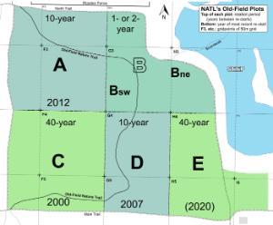
-
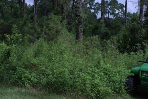
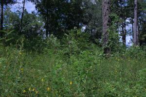
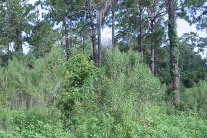
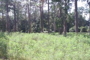
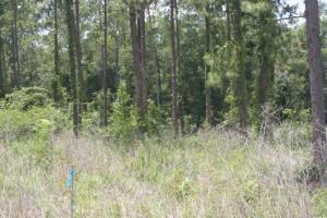
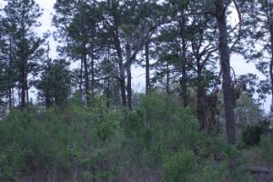
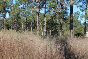
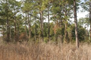
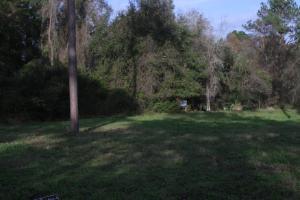
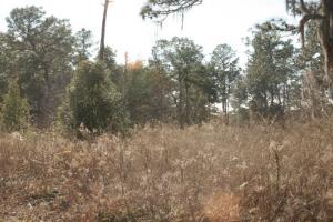
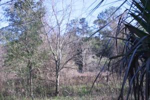
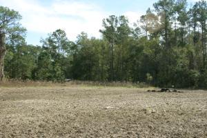
Old-Field Plot A: Summer Photos: 2007-date
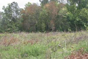
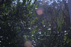
The photos below are of Old-Field Plot A, a 10-year-rotation plot first started in March 2002. All photos were taken from gridstake G4, looking northwest toward gridstake F3.
In Plot A, the saltbush saplings that were prominant in the foreground of the June 2007 photograph are absent because the scattered saltbush in the northern two-thirds of the plot was cut, whereas the thick stand of saltbush in the southern one-third was left in tact. [This management was approved by NAAC as appropriate for a 40-year plot judged to owe its abundant saltbush to the spoil from the SEEP basin that was spread on it.]
29 July 2020
(Started March 2002)
10 August 2019
(Started March 2002)
10 August 2017
(Started March 2002)
18 August 2016
(Started March 2002)
29 July 2015
(Started March 2002)
29 July 2014
(Started March 2002)
15 July 2013
(Started March 2002)
14 July 2010
(Started March 2002)
30 July 2009
(Started March 2002)
21 July 2008
(Started March 2002)
15 June 2007
(Started March 2002)
-
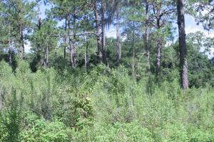
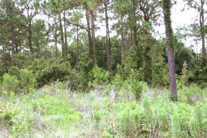
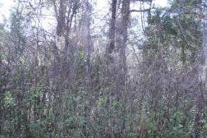
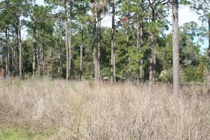
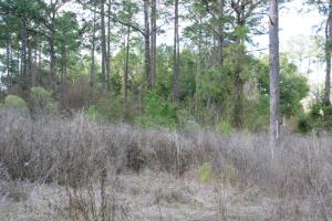
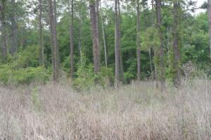
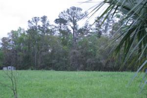
Old-Field Plot B: Summer Photos: 2007-date
The photos below are of Old-Field Plot B, a plot that is tilled (all or in part) in most (but not all) years. All of Plot B was first tilled in November 2001; all was tilled again in April 2003 and in January 2005. When the old-field nature trail was developed in 2006, it divided Plot B into an eastern portion (in the foreground of the photos) and a larger, western portion (in the middleground of the photos). Starting in November 2006 with the tilling of the east-of-trail portion of Plot B, the two portions were tilled separately as indicated in the notes beside the images. All photos were taken from gridstake G4, looking northeast toward gridstake H3.
29 July 2020 
10 August 2019 
10 August 2017 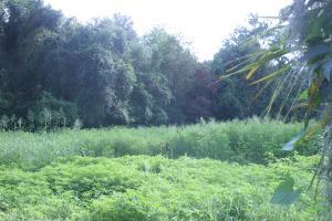
18 August 2016 29 July 2015 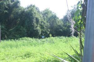
29 July 2014 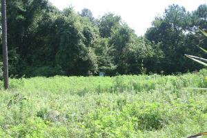
15 July 2013 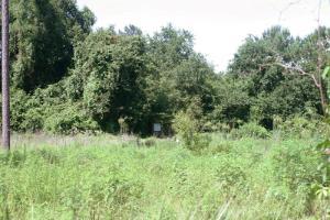
12 August 2012 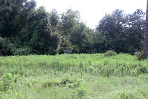
28 July 2011 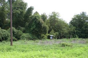
14 July 2010 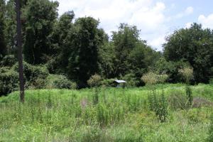
30 July 2009 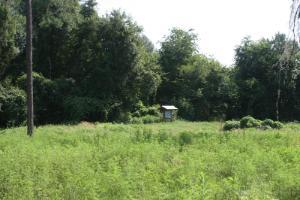
21 July 2008 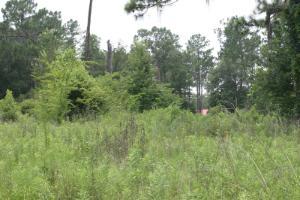
15 June 2007 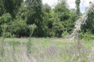
-
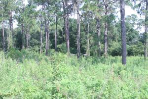
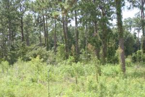
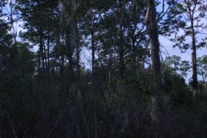
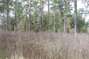
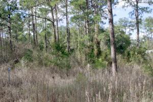
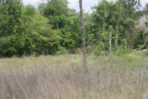
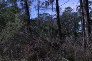
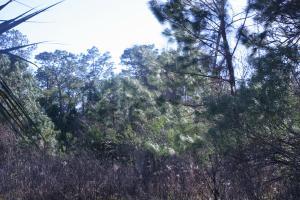
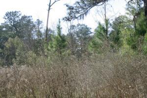
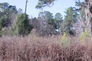
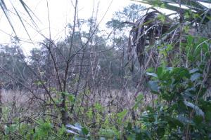
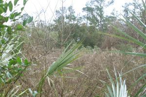
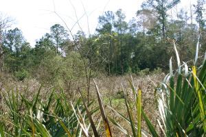
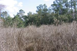
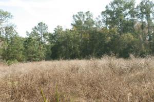
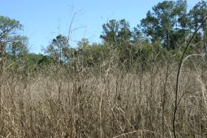
Old-Field Plot C: Summer Photos: 2007-date
The photos below are of Old-Field Plot C, a 40-year-rotation plot first started in November 2000. All photos were taken from gridstake G4, looking southwest toward gridstake F5.
29 July 2020 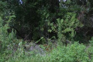
10 August 2019 10 August 2017 18 August 2016 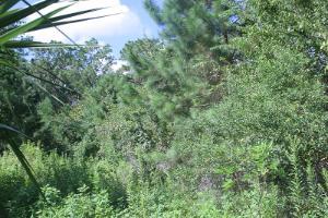
29 July 2015 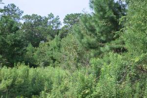
29 July 2014 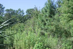
15 July 2013 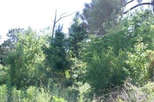
08 August 2012 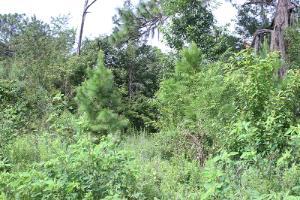
28 July 2011 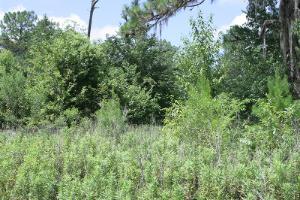
14 July 2010 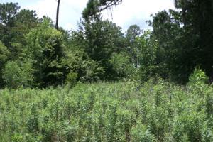
30 July 2009 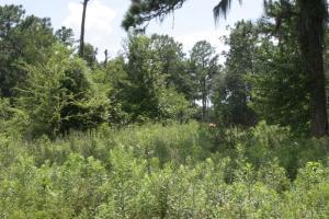
21 July 2008 15 June 2007 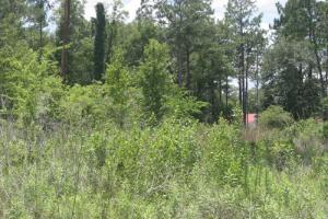
-
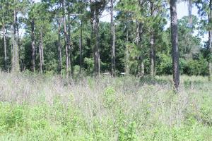
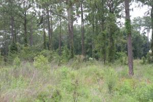
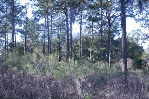
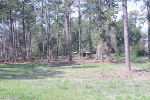
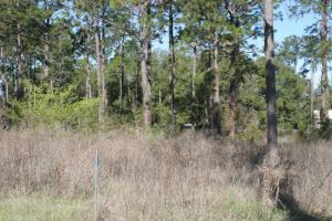
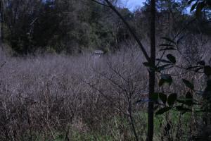
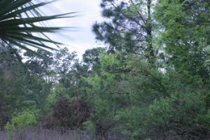
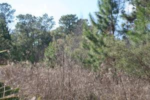
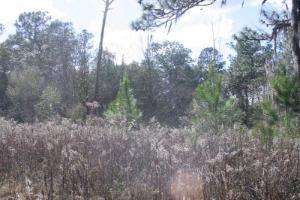
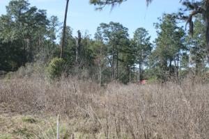
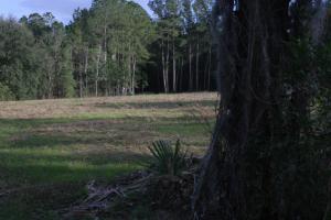
Old-Field Plot D: Summer Photos: 2007-date
The photos below are of Old-Field Plot D, a 10-year-rotation plot first started in 1997. The photos begin in the summer of 2007 as the plot was being prepared for its first re-start later that year. (Trees had been cut and removed from the plot during the winter.) All photos were taken from gridstake G4, looking southeast toward gridstake H5.
29 July 2020
(Re-started August 2017)
-300x200.jpg)
10 August 2019
(Re-started August 2017)
-300x200.jpg)
10 August 2017
(Re-started August 2017)
18 August 2016
(Re-started December 2007)
-300x200.jpg)
29 July 2015
(Re-started December 2007)
-300x200.jpg)
29 July 2014 (Re-started December 2007) -300x200.jpg)
15 July 2013 (Re-started December 2007) -300x200.jpg)
14 July 2010 (Re-started December 2007) -300x200.jpg)
30 July 2009 (Re-started December 2007) -300x200.jpg)
21 July 2008 (Re-started December 2007) -300x200.jpg)
15 June 2007 (Started February 1997) -300x200.jpg)
-
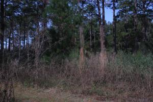
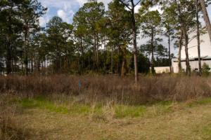
Old-Field Plot A: Winter Photos: 2007-date
The photos below are of Old-Field Plot A, a 10-year-rotation plot first started in March 2002. All photos were taken from gridstake G4, looking northwest toward gridstake F3.
14 January 2021
(Started December 2012)
10 January 2020
(Started December 2012)
08 January 2019
(Started December 2012)
16 March 2018
(Started December 2012)
02 February 2017
(Started December 2012)
04 February 2016
(Started December 2012)
30 January 2015
(Started December 2012)
15 January 2014
(Started December 2012)
25 January 2013
(Started December 2012)
26 January 2012
(Started March 2002)
24 January 2011
(Started March 2002)
20 January 2010
(Started March 2002)
4 February 2009
(Started March 2002)
19 January 2009
(Started March 2002)
21 January 2008
(Started March 2002)
30 March 2007
(Started March 2002)
-
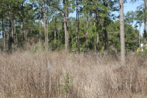
Old-Field Plot B: Winter Photos: 2007-date
The photos below are of Old-Field Plot B, a plot that is tilled (all or in part) in most (but not all) years. All of Plot B was first tilled in November 2001; all was tilled again in April 2003 and in January 2005. When the old-field nature trail was developed in 2006, it divided Plot B into an eastern portion (in the foreground of the photos) and a larger, western portion (in the middleground of the photos). Starting in November 2006 with the tilling of the east-of-trail portion of Plot B, the two portions were tilled separately as indicated in the notes beside the images. All photos were taken from gridstake G4, looking northeast toward gridstake H3.
14 January 2021
(Started December 2012)
10 January 2020
(Started December 2012)
08 January 2019 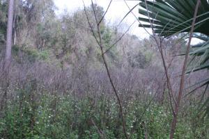
16 March 2018 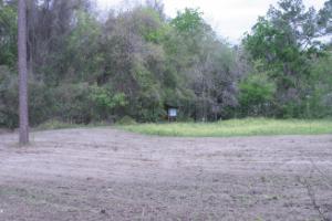
02 February 2017 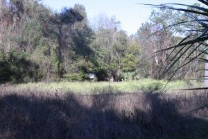
04 February 2016 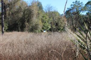
30 January 2015 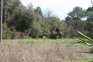
15 January 2014 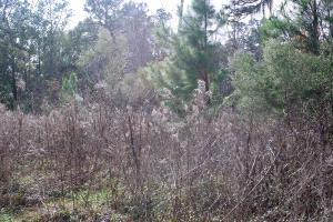
25 January 2013 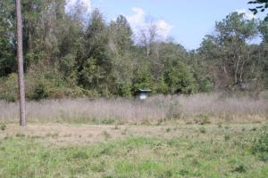
26 January 2012 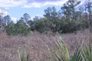
26 January 2011 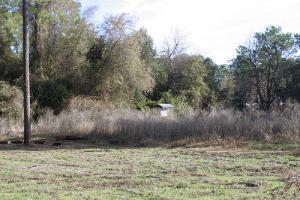
20 January 2010 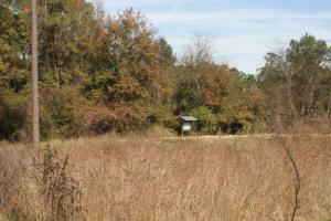
4 February 2009 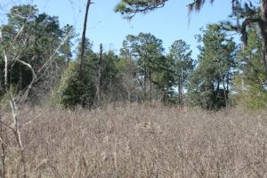
19 January 2009 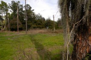
29 January 2008 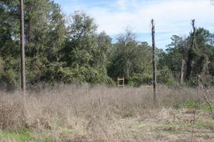
30 March 2007 -
Old-Field Plot C: Winter Photos: 2007-date
The photos below are of Old-Field Plot C, a 40-year-rotation plot first started in November 2000. All photos were taken from gridstake G4, looking southwest toward gridstake F5.
14 January 2021
(Started December 2012)
10 January 2020
(Started December 2012)
08 January 2019
(Started November 2000)
16 March 2018
(Started November 2000)
02 February 2017
(Started November 2000)
04 February 2016
(Started November 2000)

30 January 2015
(Started November 2000)
15 January 2014
(Started November 2000)
26 January 2013
(Started November 2000)
26 January 2012
(Started November 2000)
26 January 2011
(Started November 2000)
20 January 2010
4 February 2009
(Started November 2000)
January 2008
(Started November 2000)
30 March 2007
(Started November 2000)
-
Old-Field Plot D: Winter Photos: 2007-date
The photos below are of Old-Field Plot D, a 10-year-rotation plot first started in 1997. The photos begin in the winter of 2007 as the plot was being prepared for its first re-start later that year. (Trees had been cut and removed from the plot during the winter.) All photos were taken from gridstake G4, looking southeast toward gridstake H5.
14 January 2021
(Started December 2012)
10 January 2020
(Started December 2012)
08 January 2019
(Re-started December 2007)
16 March 2018
(Re-started December 2007)
02 February 2017
(Re-started December 2007)
04 February 2016
(Re-started December 2007)
30 January 2015
(Re-started December 2007)
15 January 2014
(Re-started December 2007)
25 January 2013
(Re-started December 2007)
26 January 2012
(Re-started December 2007)
24 January 2011
(Re-started December 2007)
20 January 2010
(Re-started December 2007)
4 February 2009
(Re-started December 2007)
29 January 2008
(Re-started December 2007)
30 March 2007
(Started February 1997)