![]()
![]()
![]()
![]()
![]()
![]()
![]()
![]()
![]()
![]()
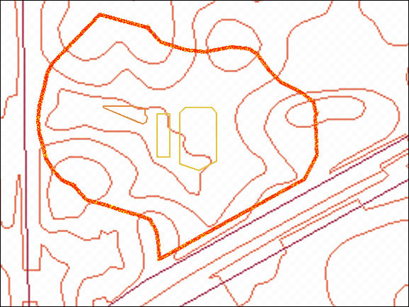 |
Topography of the karst basin into which most of the proposed right-of-way drains (five-foot contour lines). The basin's limits are shown by the orange outline. Click on the thumbnail to see (from left to right) the triangular outline of the sink that is the lowest surface in the basin, the small rectangle that is a retention pond for Bennigan's, and the larger, near-rectangular retention pond that serves Archer Woods and commercial property on Archer Road. | 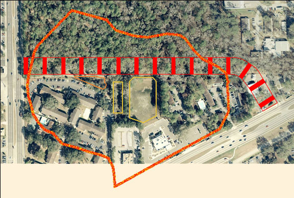 |
Aerial photograph onto which the outlines of the basin, the right-of-way, the sink, and the two retention ponds have been superimposed. The overflows from the two ponds are directed via floodways to the sink. |
 |
In this close-up view, the sink is in the point of the triangular area formed where the Regency Oaks parking area veers southward after paralleling the NATL boundary. Clearly visible are the small retention pond for Bennigan's and the larger one for Archer Woods Apartments and commercial property on Archer Road. |
 |
Sink at Regency Oaks on 10 Mar 2003, after a two-inch rain on 9 Mar 2003. Note NATL's boundary fence, which is nominally 6 inches north (toward upper right in this view) of the UF property line. NATL's South Trail runs along this fence and was flooded in two places after the rain of 9 March (see photos below). |
 |
Sink on 10 Mar 2003, looking east-northeast from Regency Oaks property. |
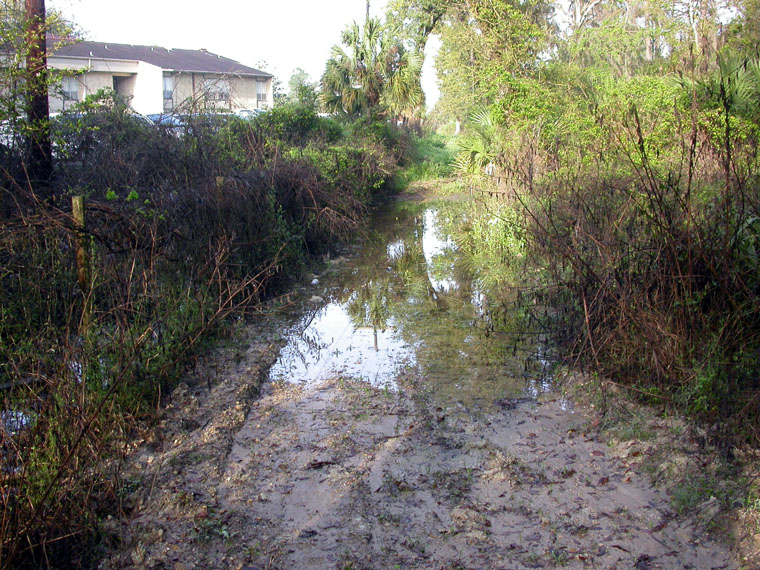 |
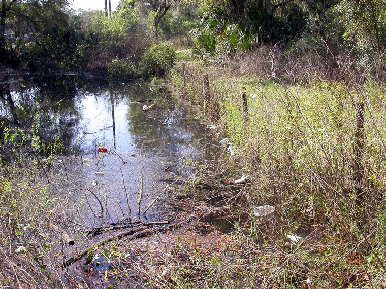
One of two places where the sink at Regency Oaks overflowed onto the proposed right-of-way after the rain of 9 Mar 2003. (Looking west along NATL's South Trail, 10 March) |
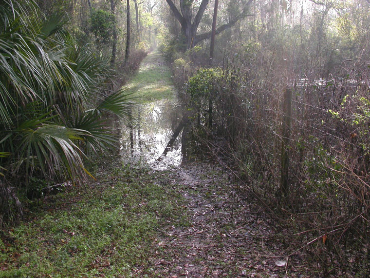 |
The other place where the sink at Regency Oaks overflowed onto the proposed right-of-way after the rain of 9 Mar 2003. (Looking east along NATL's South Trail, 10 March.) |
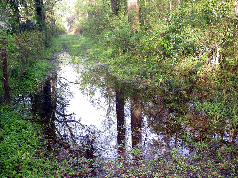 |
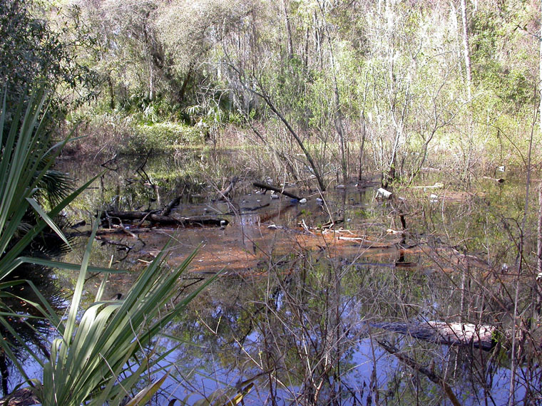
A series of swales on the proposed right-of-way between the sink at Regency Oaks and the Classic Car Wash property hold water for several days after a minor storm event. This one, the most prominent on South Trail, held water for four days after the rain of 9 Mar 2003. (Picture taken on 10 Mar 2003.) |
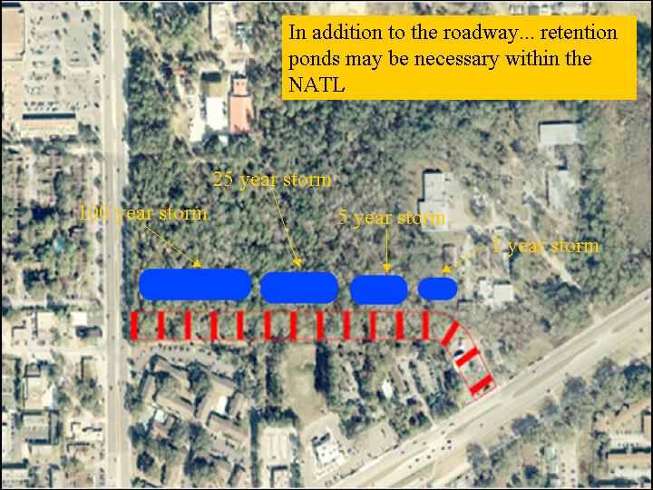 |
Aerial photograph showing how much more additional land would be needed from NATL to provide retention ponds for 1-, 5-, 25-, and 100-year storms. [More information about water issues.] |