 |
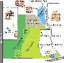
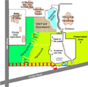
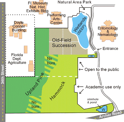
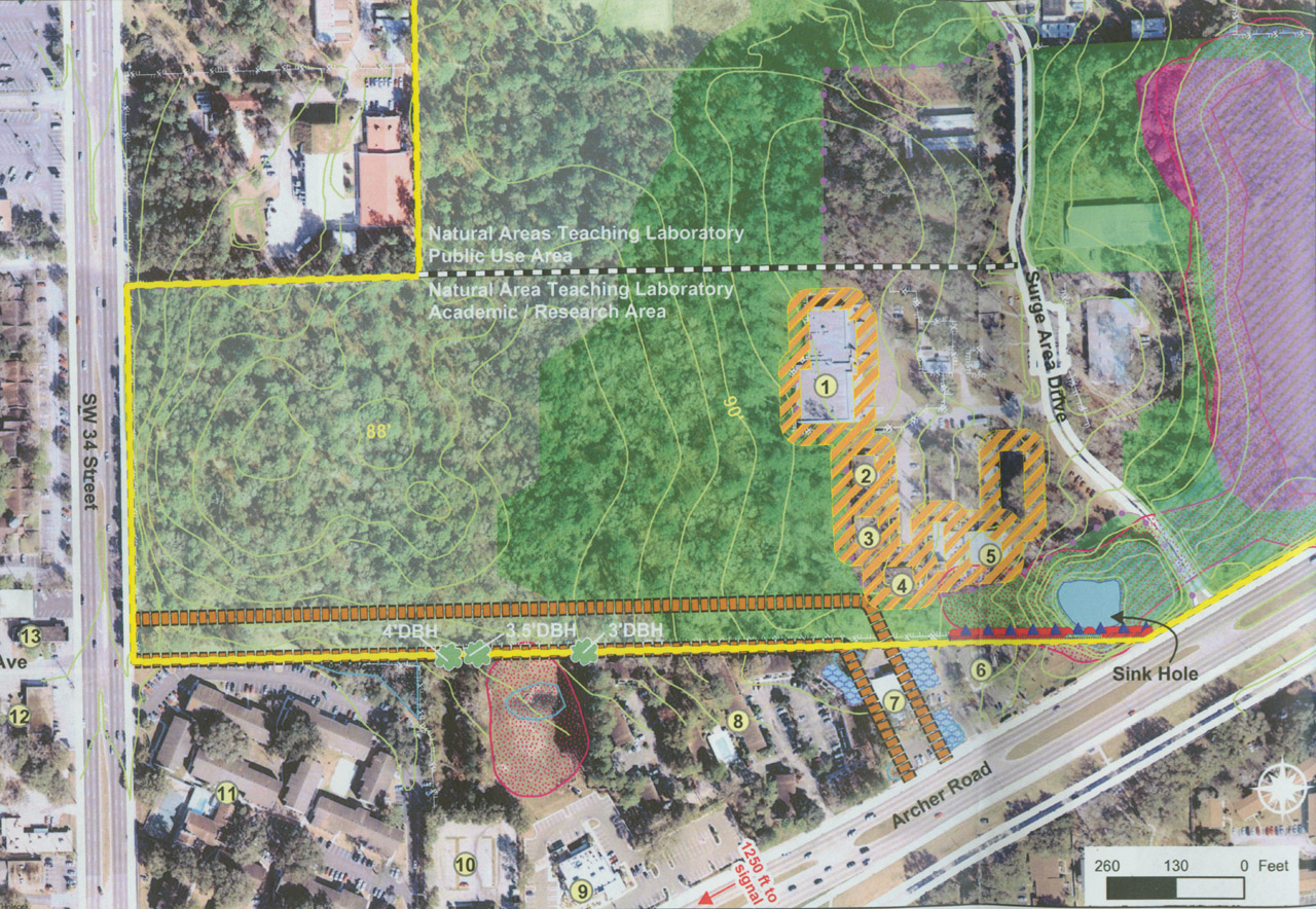
Map of NATL showing its principal ecosystems and the division between public and academic areas. |
 |
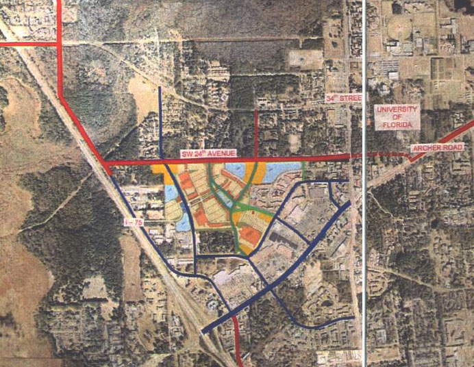
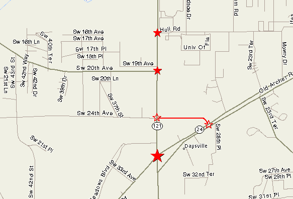
Map of proposed east-west traffic corridor distributed at the 31 Jan 2003 meeting of the County Commission (minutes) |
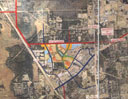 |
Portion of above map showing a proposed "Butler Plaza North". |
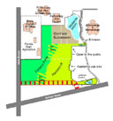 |
Map of NATL with the right-of-way of the proposed extension of SW 24th Avenue superimposed and assumptions explained. |
 |
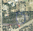
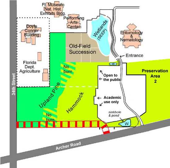
Map showing how the proposed extension of SW 24th Avenue will sever the current connection between Preservation Area 2 and the main body of NATL. |
 |
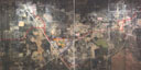
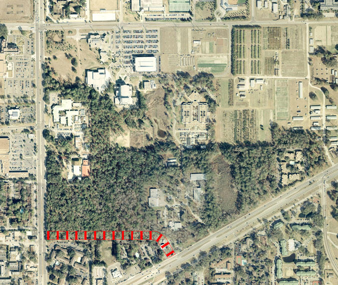
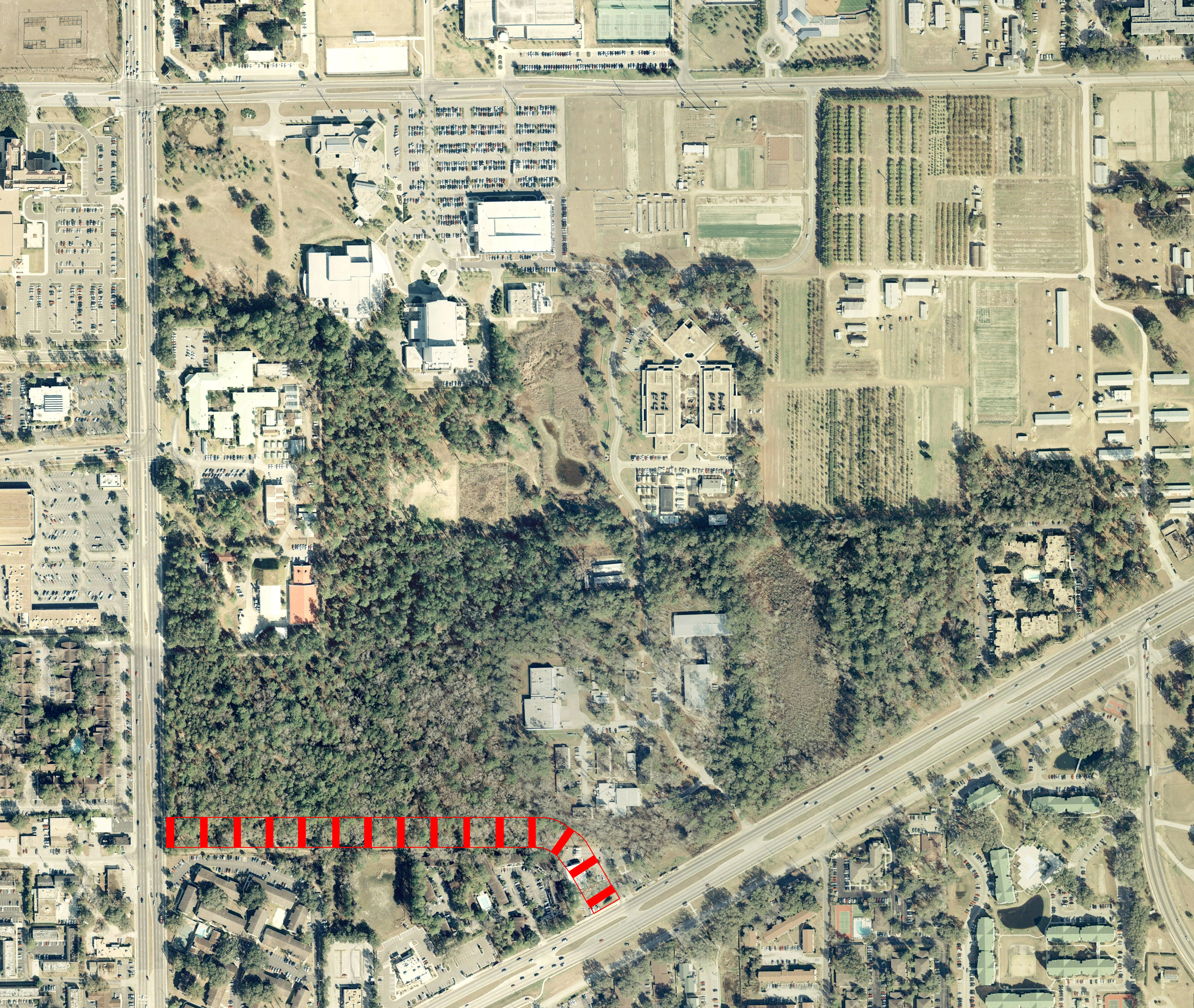
Aerial photograph of NATL, taken in 2000, with the right-of-way of the proposed extension of SW 24th Avenue superimposed. [Highest resolution (8.17MB)] |
 |
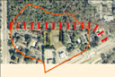
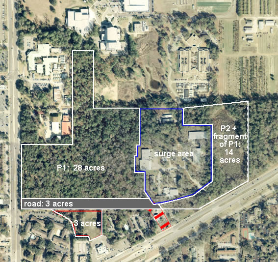
Aerial photograph showing how 48 acres of continuous wild lands will be reduced to fragments of 28, 14, and 3 acres (with only 3.1 acres destroyed by the proposed extension of SW 24th Avenue). P1 in the enlarged image is Preservation Area 1, all of which is included in NATL. P2 is Preservation Area 2, which currently contacts P1 at the south end of Surge Area Drive (see Fig. 2 in Levey's paper). The fragment south of the proposed road contains the collapsed sink at the bottom of a large karst basin (see below). The pond at this sink and the pond in the cut-off portion of P1 are the currently the most accessible standing water for animals in the 25-acre fragment to the north.
|
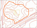 |
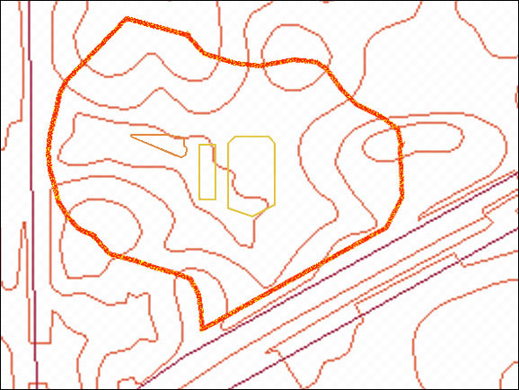
Topography of the karst basin into which most of the proposed right-of-way drains (five-foot contour lines). The basin's limits are shown by the orange outline. Click on the thumbnail to see (from left to right) the triangular outline of the sink that is the lowest surface in the basin, the small rectangle that is the the Regency Oaks retention pond, and the larger, near-rectangular retention pond that serves Archer Woods and commercial property on Archer Road. |
 |
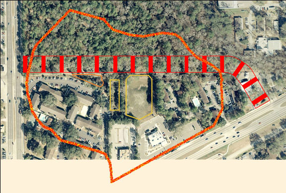
Aerial photograph onto which the outlines of the basin, the right-of-way, the sink, and the two retention ponds have been superimposed. The overflows from the two ponds are directed via floodways to the sink. |
 |
In this close-up view, the sink is in the point of the triangular area formed where the Regency Oaks parking area veers southward after paralleling the NATL boundary. Clearly visible are the small retention pond for Regency Oaks and the larger one for Archer Woods Apartments and commercial property on Archer Road. [More information about the sink and about water issues.] |


