![]()
![]()
![]()
![]()
![]()
![]()
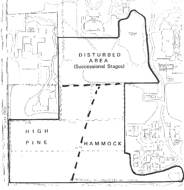 |
1. Long-term management plan (1994-date) When the Natural Area Advisory Committee (NAAC) began its work in September 1994 it adopted the land-use plan that was in the 1993 proposal for a "Campus Natural Area and Outdoor Teaching Laboratory," approved by UF's Land Use and Facilities Planning Committee in May 1994. The current map and plan are refinements of the original ones. |
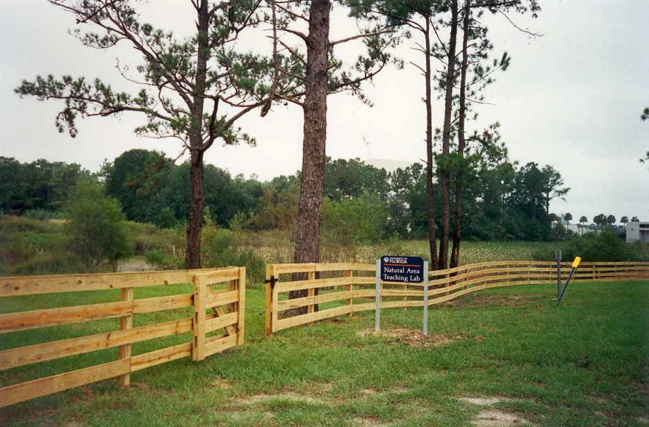 |
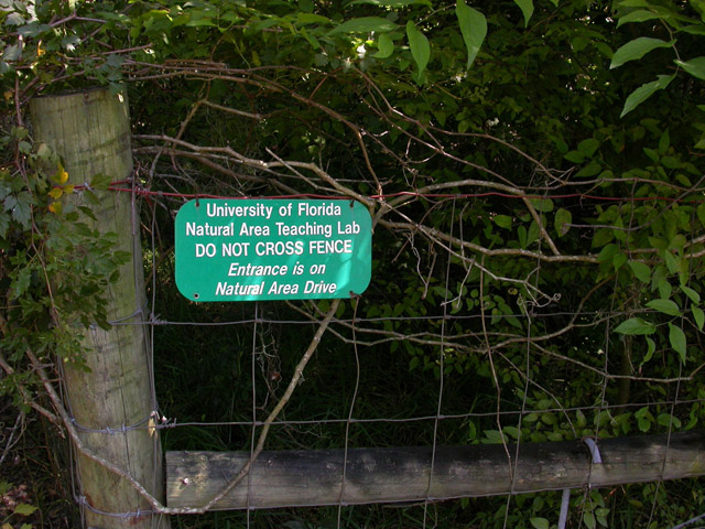
2. Corral fence and sign at east entrance (1995) This fence and sign were the first improvements sought and obtained by NAAC. The fence was funded by College of Agriculture Dean Larry Connor and the sign was provided by the Physical Plant Division. |
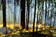 |
3. Upland pine ecosystem restored (1995-date) As illustrated and described elsewhere, NATL's upland pine ecosystem was choked with laurel oaks in 1995. By 2004, after six prescribed burns and the cutting or killing of hundreds of the invading oaks, the ecosystem was once more hospitable to the germination of the seeds of longleaf pines and the growth of their seedlings. |
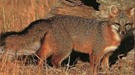 |
4. Surveys of biota (1995-date) Higher plants, vertebrates, and many groups of invertebrates that occur in NATL have been surveyed and the results posted. |
 |
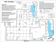
5. 50-meter grid surveyed and staked (1996-date) In 1995-1996, the Student Geomatics Association (SGA) surveyed a grid system for NATL. Surveyed points were at 100-meter intervals, but stakes were installed at 50-meter intervals; three years later SGA volunteers resurveyed the grid and placed metal markers at 50-meter intervals to mark all grid intersections. In 2006-07, SGA expanded the grid to include 14 acres added to NATL in 2005. |
 |
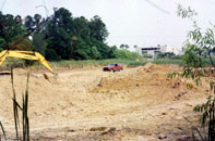
6. South and east boundary fences (1997) Prior to the construction of this fence, NATL's south boundary was open to vagrants who entered via a path from Bennigan's parking lot. During the routing of the fence, NATL's boundary with the Surge Area was refined by UF's Land Use and Facility Planning Committee to include in NATL the retention pond that serves the Surge Area's mini-warehouses. |
 |
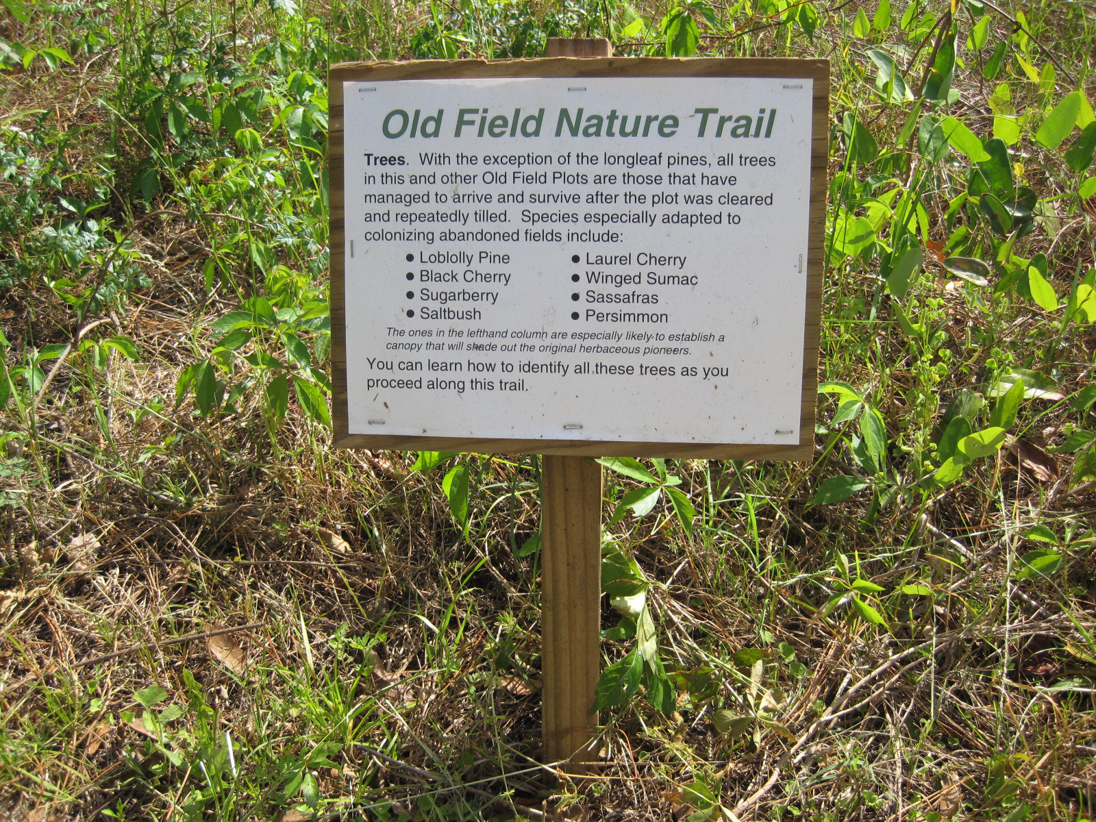
7. Old-field plots established and maintained (1997-date) As illustrated and described elsewhere, five plots have been established and are being managed to permanently display varied stages of old-field succession. |
  |
8. Grid-based photographic record of vegetation (1997, 2007-08) In January 1997, a photographic record was made of NATL by taking pictures to the north, east, south, and west at each grid intersection. This was repeated for NATL-west in 2007 and NATL-east in 2008. |
 |
9. Retention basin re-contoured for SEEP (1998) The retention basin in the northeast corner of NATL is the site of the Stormwater Ecological Enhancement Project (SEEP). This project of the Wetlands Club required that the basin be re-contoured to establish a variety of fresh water habitats, including a water-treatment forebay, a cypress swamp, a tree island, herbaceous marshes, and permanent pools of open water. |
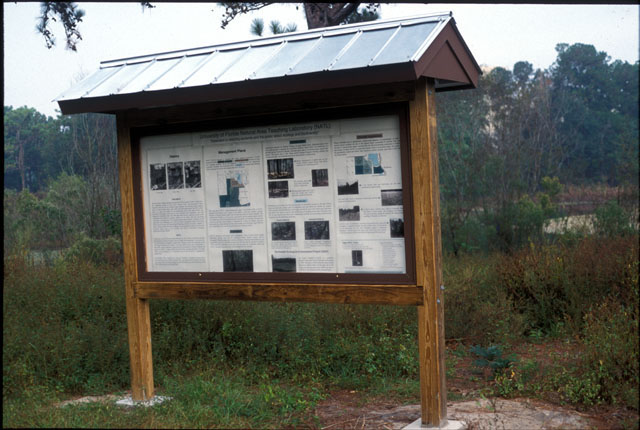 |
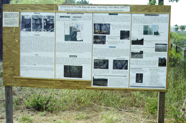
10. Kiosk for academic entrance (1998) This kiosk, along with one that was later installed in Natural Area Park, was constructed in the shop at the Florida Museum of Natural History and partially funded from a grant by the Division of Cultural Affairs, Florida Department of State. It replaced a temporary display board. Current displays on kiosk. |
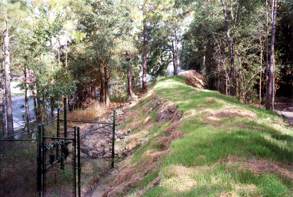 |
11. Berm along 34th Street (1999) This is the northern half of a 670 ft long, 7 ft high earthen berm constructed to reduce the impact of 34th Street traffic along the eastern edge of the southern block of NATL's upland pine. The berm removes visual distractions and attenuates traffic noise to some extent. Unfortunately it also reduces the area that can be maintained as upland pine. |
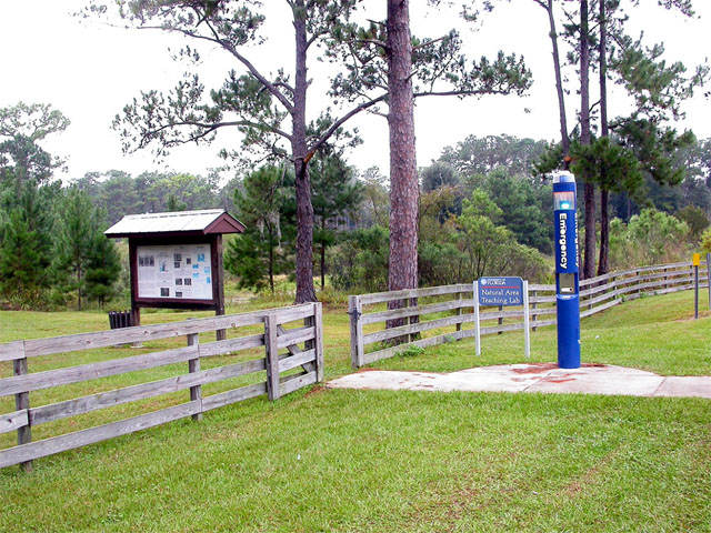 |
12. Blue-light emergency phone installed (2000) This emergency phone at NATL's academic entrance was recommended in a University Police Department security survey and funded by the UF Administration. |
 |
13. Grid-based record of soils (2000) Personnel in the Soil and Water Science Department, led by Dr. Mary E. Collins, surveyed and mapped NATL soils. |
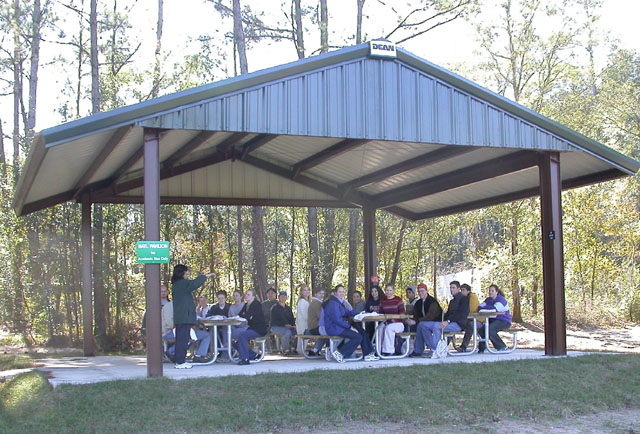 |
14. Academic pavilion (2002) This all-steel, 32 x 27 ft pavilion provides shelter, seating, and work tables for classes and individuals who use NATL. Its six tables accommodate as many as 38 students, including two in wheel chairs. It was funded by the Provost and the CALS Dean and erected with the help of IFAS Facilities Operations. |
 |
15. Natural Area Park (2003) As described and illustrated elsewhere, Natural Area Park is an interface between the Cultural Complex and NATL. It provides a shady respite for the public and a place for the K-12 groups visiting the Florida Museum of Natural History to eat their picnic lunches. A kiosk describes NATL and its Stormwater Ecological Enhancement Project and invites users of the park to explore them. |
 |
16. Proposed extension of SW 24th Avenue resolved (2004) In January 2003, the UF administration announced that UF would provide right-of-way from the southern edge of NATL for a four-lane, eastward extension of SW 24th Avenue. The Natural Area Advisory Committee worked to reverse this decision and maintained a web site to document the issues. In May 2004, President Bernie Machen announced that the University was withdrawing its offer to donate the right-of-way. |
 |
17. Rain gauge installed (2004) In July 2004, a rain gauge donated by the Department of Entomology and Nematology was placed on the west edge of SEEP at the junction of East and Old-Field Trails. Gainesville rains are far from spatially uniform. Data from the NATL rain gauge helps estimate NATL soil moisture, which is important in planning controlled burns and when to water recent transplants. Rainfall amounts recorded from the NATL rain gauge are kept on sheets similar to those at NATLrain.xls. |
 |
18. Surge Area wetland becomes NATL-east (2005) Eleven acres of mostly wetlands east of Natural Area/Surge Area Drive has a biota and physical features importantly different from those of the original NATL (now NATL-west). LVL approved the concept of a NATL-east at its July 2004 meeting (PowerPoint presentation), and the administration gave final approval to the addition in the spring of 2005. |
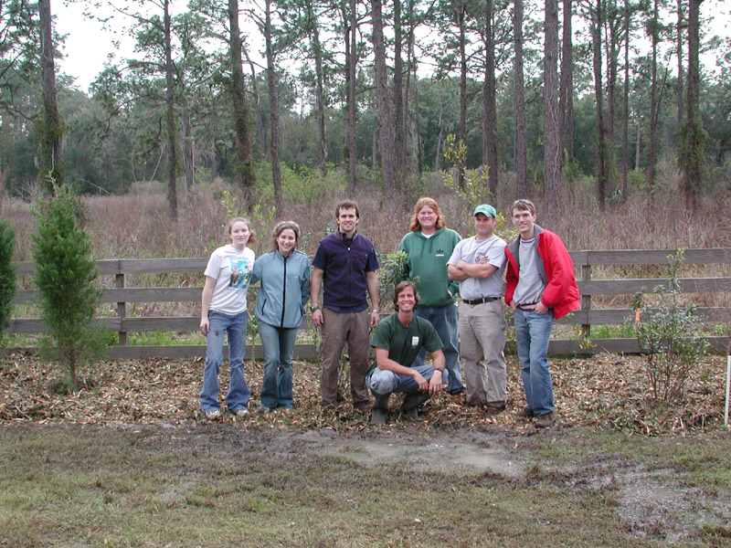 |
19. NATL Graduate Teaching Assistant (GTA) hired (2005) Kevin Ratkus (kneeling) was NATL's first GTA, serving through 2007, at which time the position was made permanent. One of the GTA's many duties is to organize events in which volunteers work to improve NATL. Here Kevin is with six volunteers who worked in the rain (and longer than agreed) to finish planting shrubs and trees that screen NATL's North Trail from the Phillips Center's rear parking lot. [The fence was later moved to the north of the planting.] |
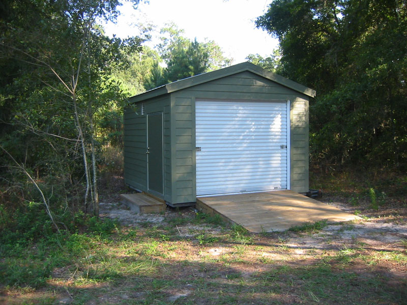 |
20. Storage builing erected (2006) NAAC was awarded money for this building from the Environmental Stewardship Project of the Capital Improvement Trust Fund (CITF). CITF is generated from student fees, and student government must approve the allocation of its funds. The storage building contains NATL's utility vehicle and other equipment and supplies. |
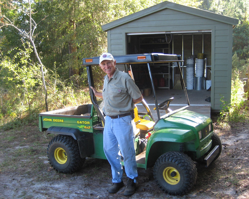 |
21. NATL acquires utility vehicle (2006) Professor Don Dickson (center), a long-time member of NATL's Natural Area Advisory Committee, donated this John Deere Gator 4x2 utility vehicle for use in developing and maintaining NATL. |
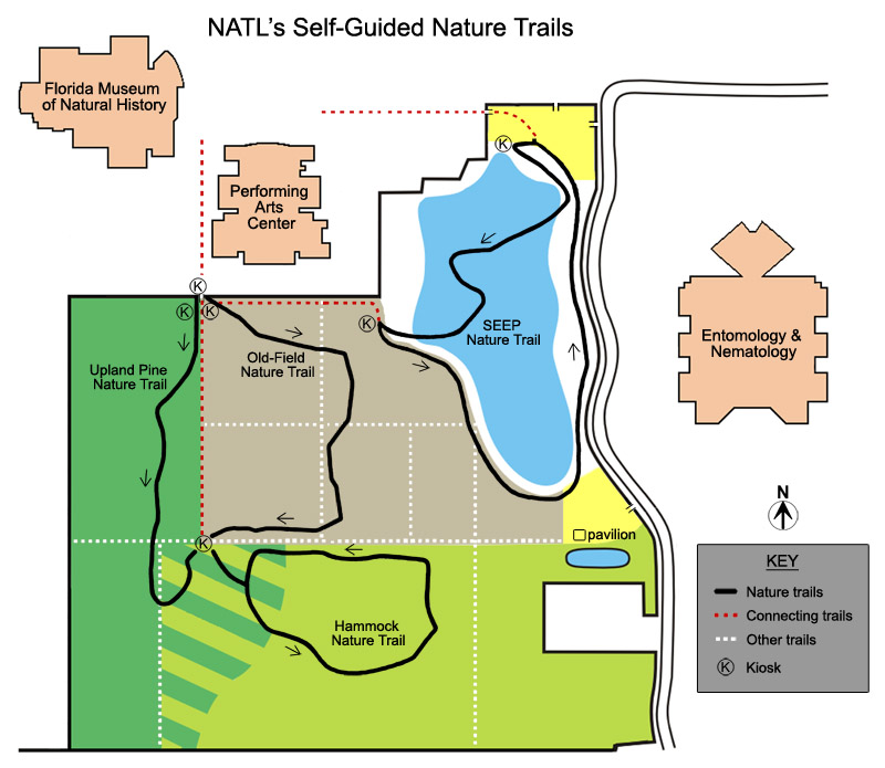 |
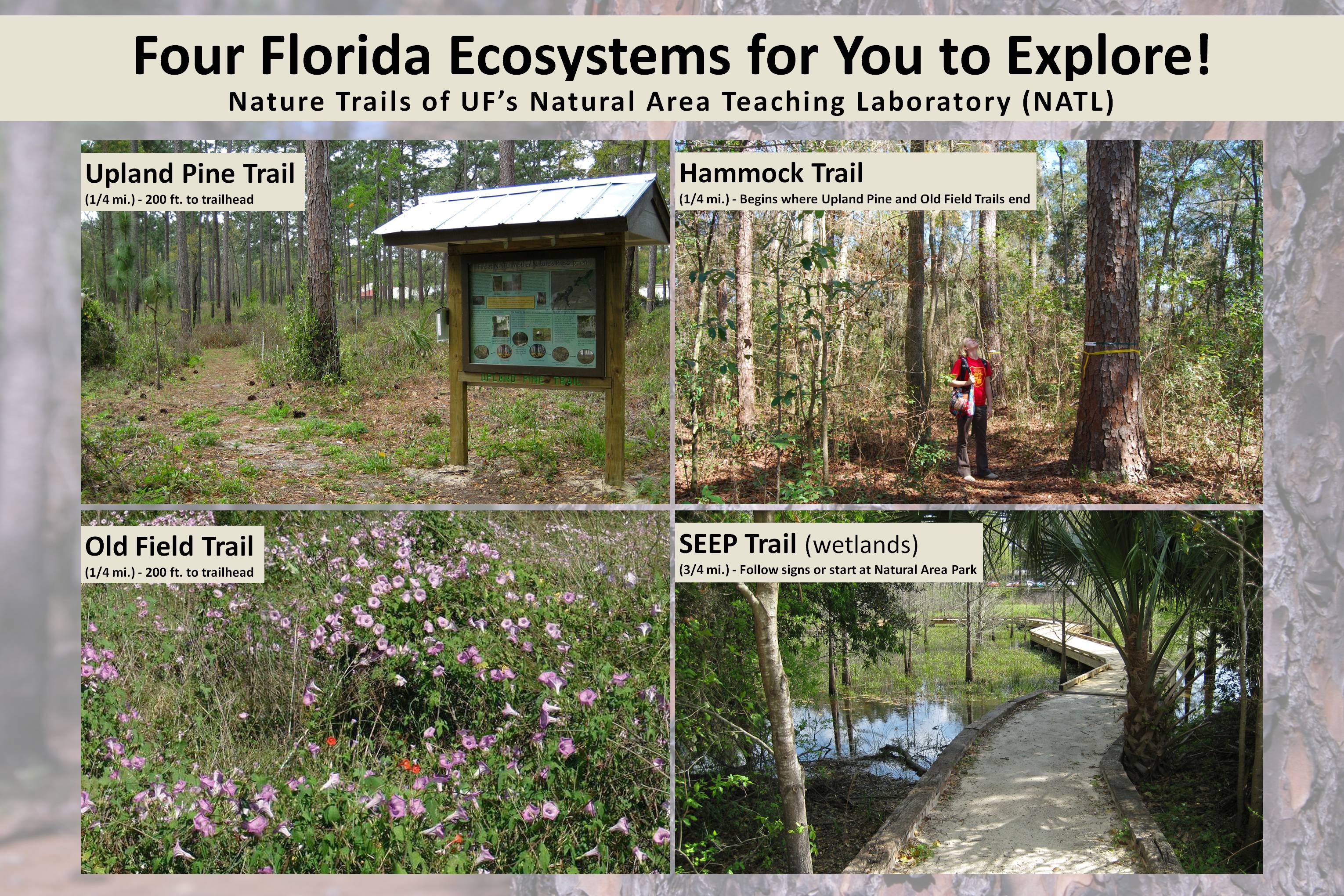
22. System of self-guided nature trails (2006) The 1993 proposal for a "Campus Natural Area and Outdoor Teaching Laboratory," which led to NATL, included a system of nature trails through the area's principal ecosystems. In 2006, NAAC was awarded money for four self-guided nature trails from the Environmental Stewardship Project of the Capital Improvement Trust Fund. For details, see NATL's Self-Guidied Nature Trails. |
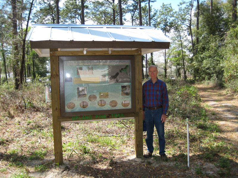 |
23. Upland nature trails (2007) The trails for the three upland ecosystems--hammock, old-field succession, and upland pine--were completed in 2007. At the start of each trail is a kiosk with an explanatory poster and a supply of trail guides. A fourth kiosk, where persons enter NATL from the Cultural Plaza, introduces the public to NATL and its nature trails. Tom Walker (on right) headed the development of these trails. |
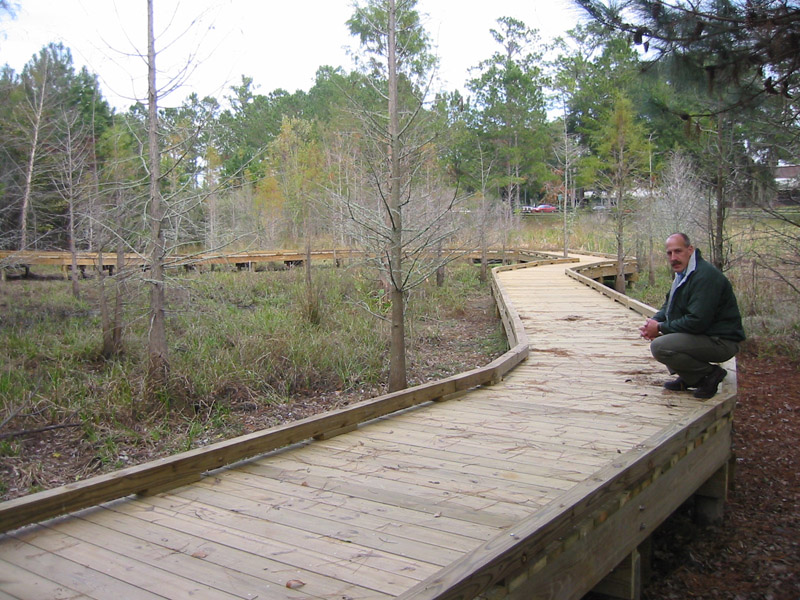 |
24. Wetland nature trail with boardwalk (2008) The SEEP Nature Trail includes a 500ft boardwalk that allows trail users to keep their feet dry as they learn how a conventional stormwater retention pond was ecologically engineered to improve its water storage and treatment functions and to be more attractive to wildlife and to human viewers. Mark Clark (on right) has headed the development of SEEP from its inception in 1995. |
 |
25. GIS map of NATL (2008) NATL Graduate Teaching Assistant Jason Martin used ArcGIS to produce a 19-layer digital map of NATL. (The map at left, showing LIDAR elevation contours, displays three of these layers.) [More information] |
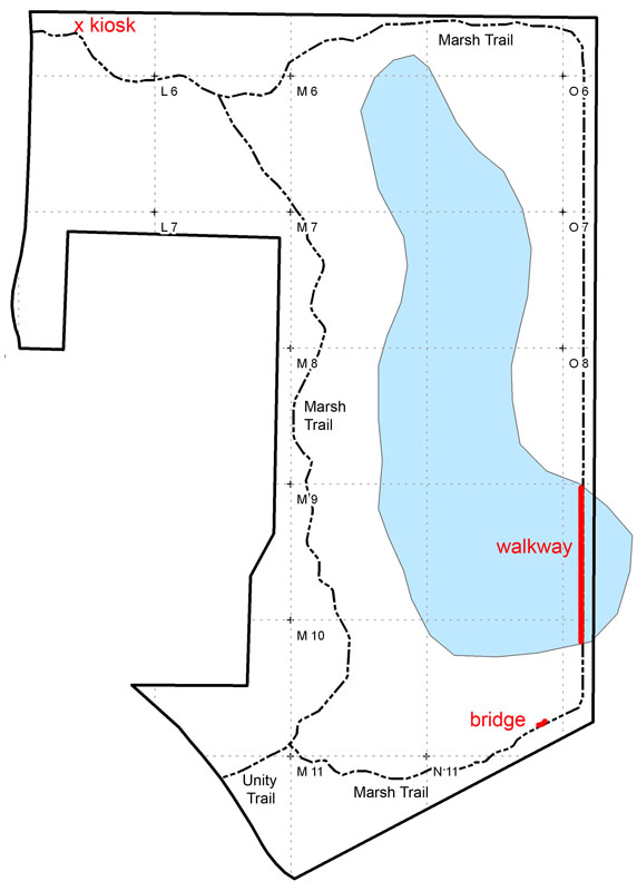 |
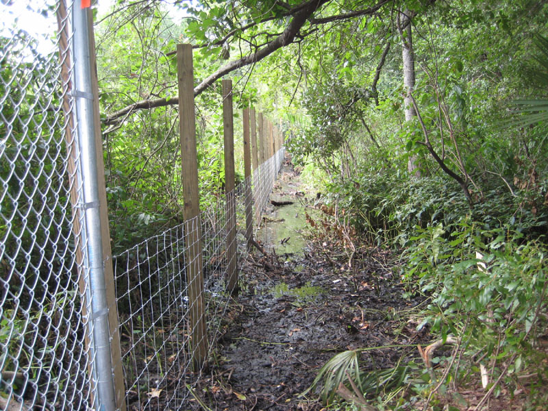
26. NATL-east improvements (2008) The Student Geomatics Association extended NATL's 50-meter grid into NATL-east, and T. J. Walker made a grid-based photographic record of its vegetation. At the north entrance to NATL-east a kiosk was installed, and across a stormwater washout, a foot bridge was built. Construction began on a walkway across an arm of the Central Marsh that extends across NATL's boundary. With the GIS map as a foundation, NATL's grid map was expanded to include NATL-east. |
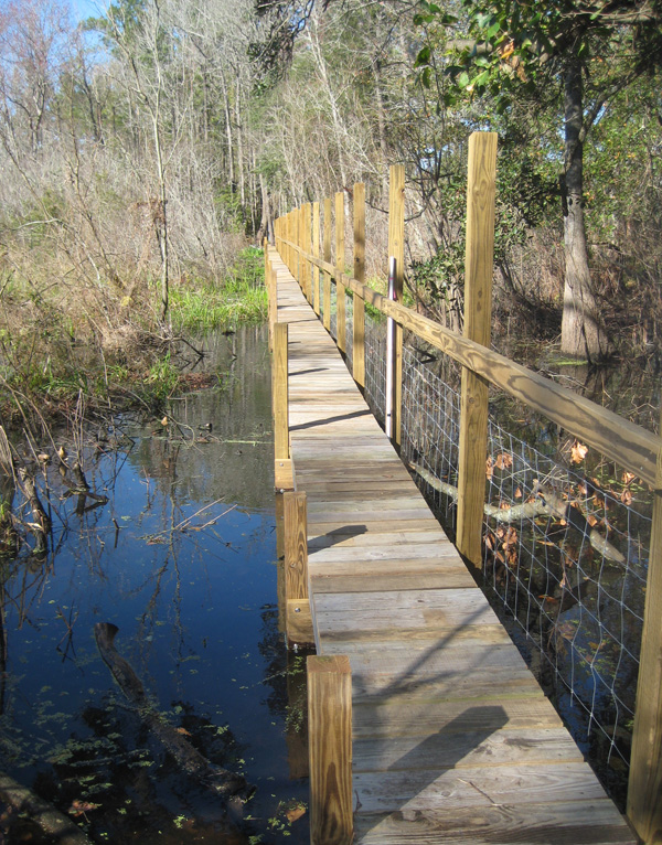 |
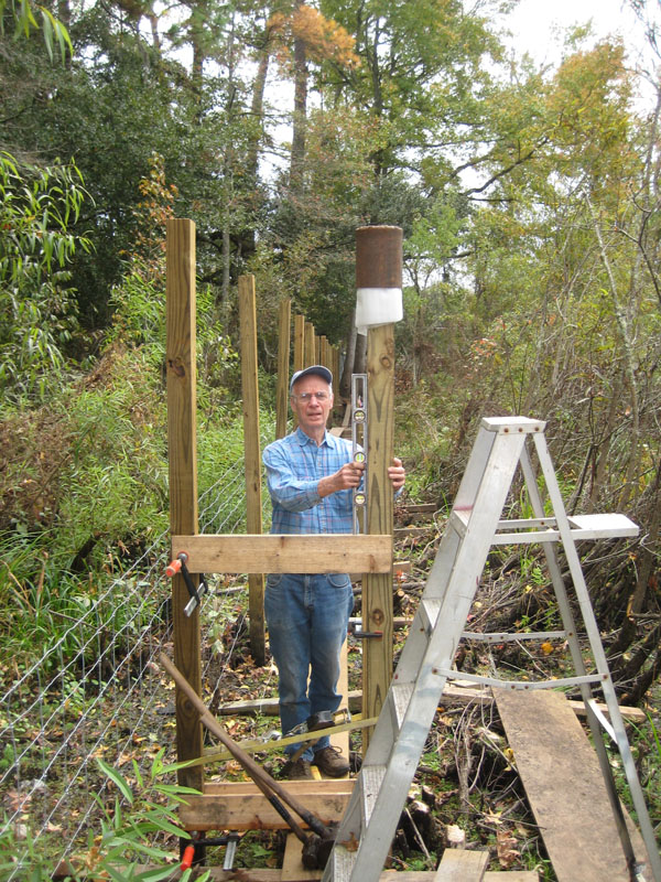
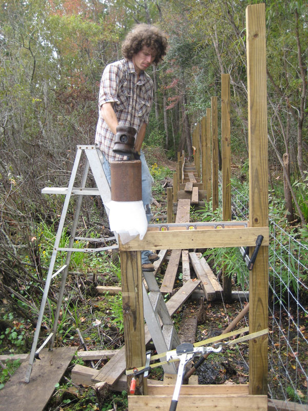
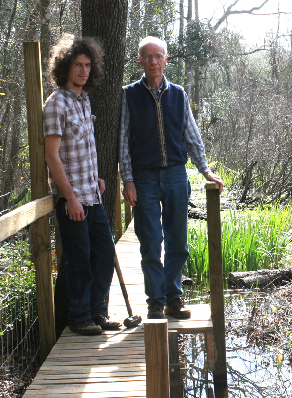
27. "Green" cross-marsh walkway (2009) T. J. Walker and Robert Guggenheim completed a 217-foot walkway across an arm of the Central Marsh, thereby closing the loop of the Marsh Trail (done!). For some pilings and for all stringers and decking, they using lumber salvaged from the building of the SEEP boardwalk and the dismantling of corral fences. This saved $1096 and reduced the total costs of materials to $1004. [More information: map, plan, as-built data, costs of materials and salvage savings] |
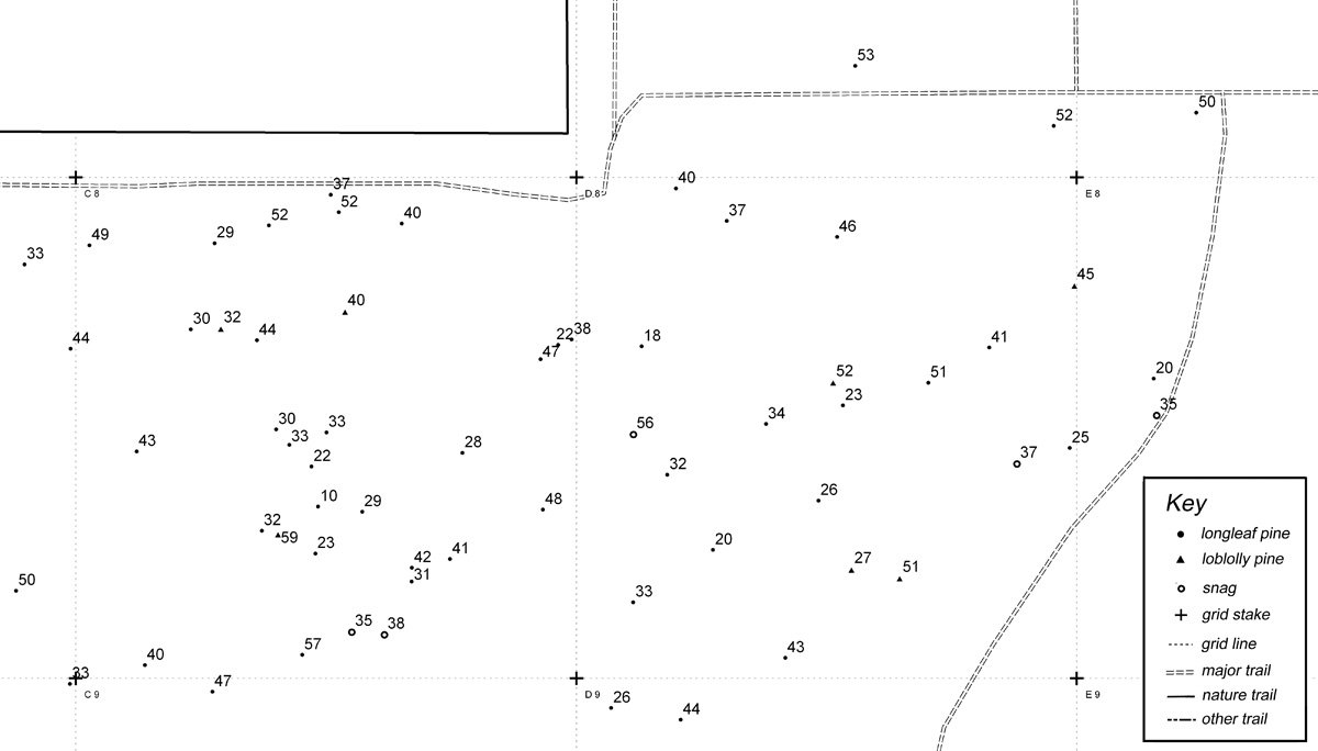 |
28. Pre-NATL pines mapped and measured (2009) Robert Guggenheim (assisted by GPS and T. J. Walker) developed a GIS layer that stores the species, DBH, position, and other noteworthy data for pines judged to have been present when NATL began in 1994. This layer is used to produce maps that show the position, diameter, and identifying number of each pine. [More information] |
 |
29. Photosigns for nature trails (2009) NATL Graduate Teaching Assistant Natalie Hooton developed this effective, flexible means of helping nature trail users learn to identify the wildflowers and other vascular plants they encounter. In the picture at left, the sign holder is at center bottom. Click on it to see the sign. [More information] |
 |
30. GPS/GIS-based maps of NATL (2010) Aided by a sub-meter GPS device, Robert Guggenheim substantially improved the accuracy of the GIS layers for NATL's boundaries, trails, grid system, and water features. He then developed more accurate and more detailed maps of NATL (click on thumbnail at left), NATL-west, and NATL-east. [More information] |
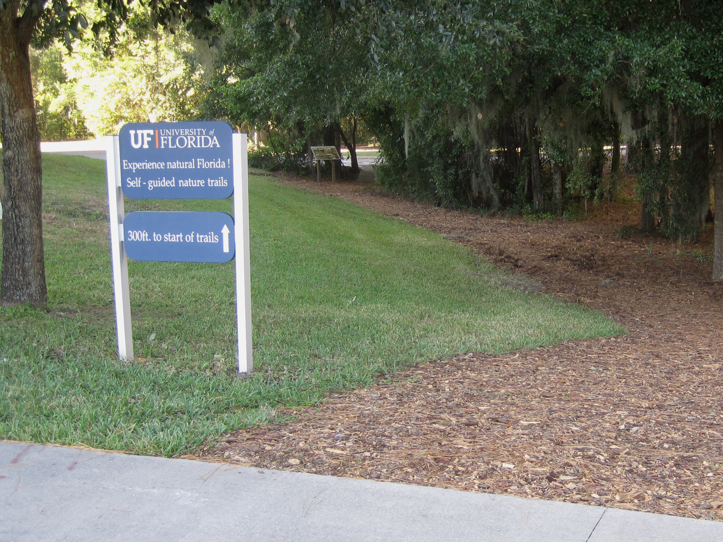 |
31. Trail from Cultural Plaza to NATL (2010) Prior to 2010, those walking from the Cultural Plaza to the trailheads of NATL's upland nature trails had to take an unmarked path down a sloping lawn between Powell Hall and the Phillip Center. UF's Physical Plant remedied the problem by constructing a mulched trail across the lawn and a small bridge across a draw where the lawn ended. The NATL advisory committee provided wayfinding signs and a 3x2ft introductory sign immediately before the bridge. |
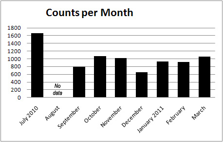 |
32. First people-counter put into service (2010) As the numbers using NATL's public area increased, it became important to have evidence of the increase and to quantify its extent. The first counter was installed at the Cultural Plaza entrance to NATL in July 2010 and initial counts have ranged from 1659 (in July when FLMNH classes were using NATL) to 647 (in December, when the weather turned cold and UF closed for the holiday break). |
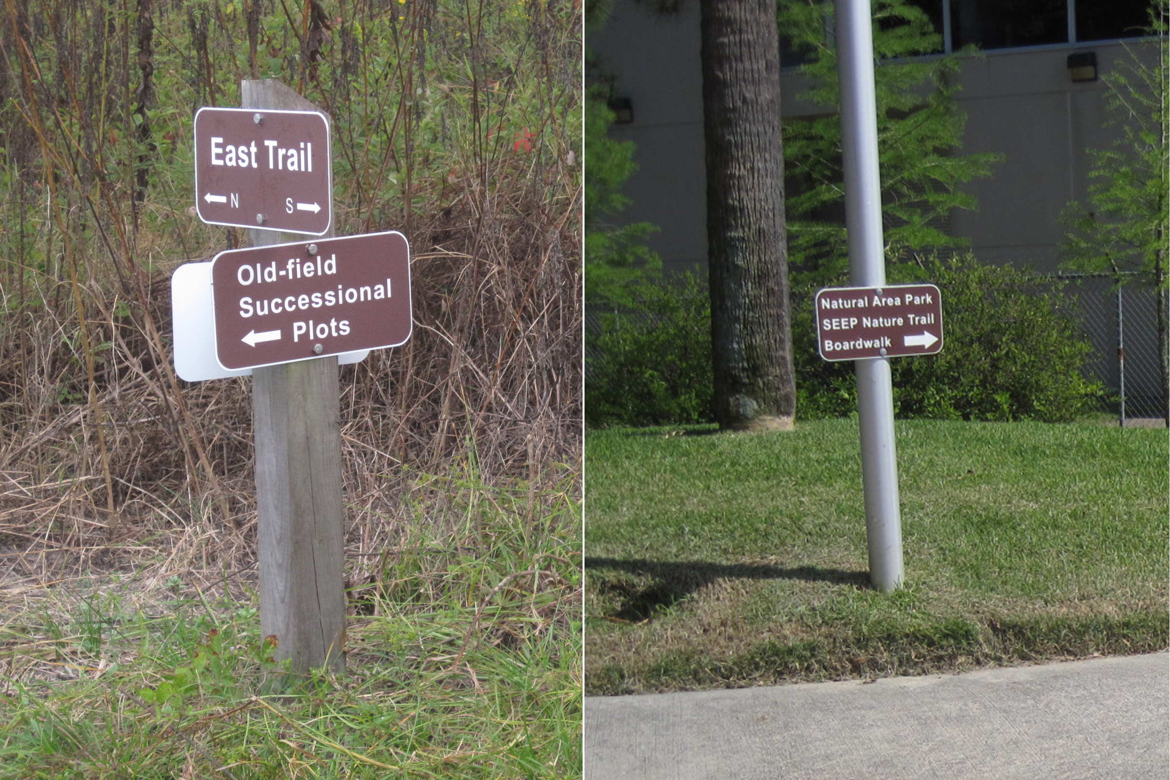 |
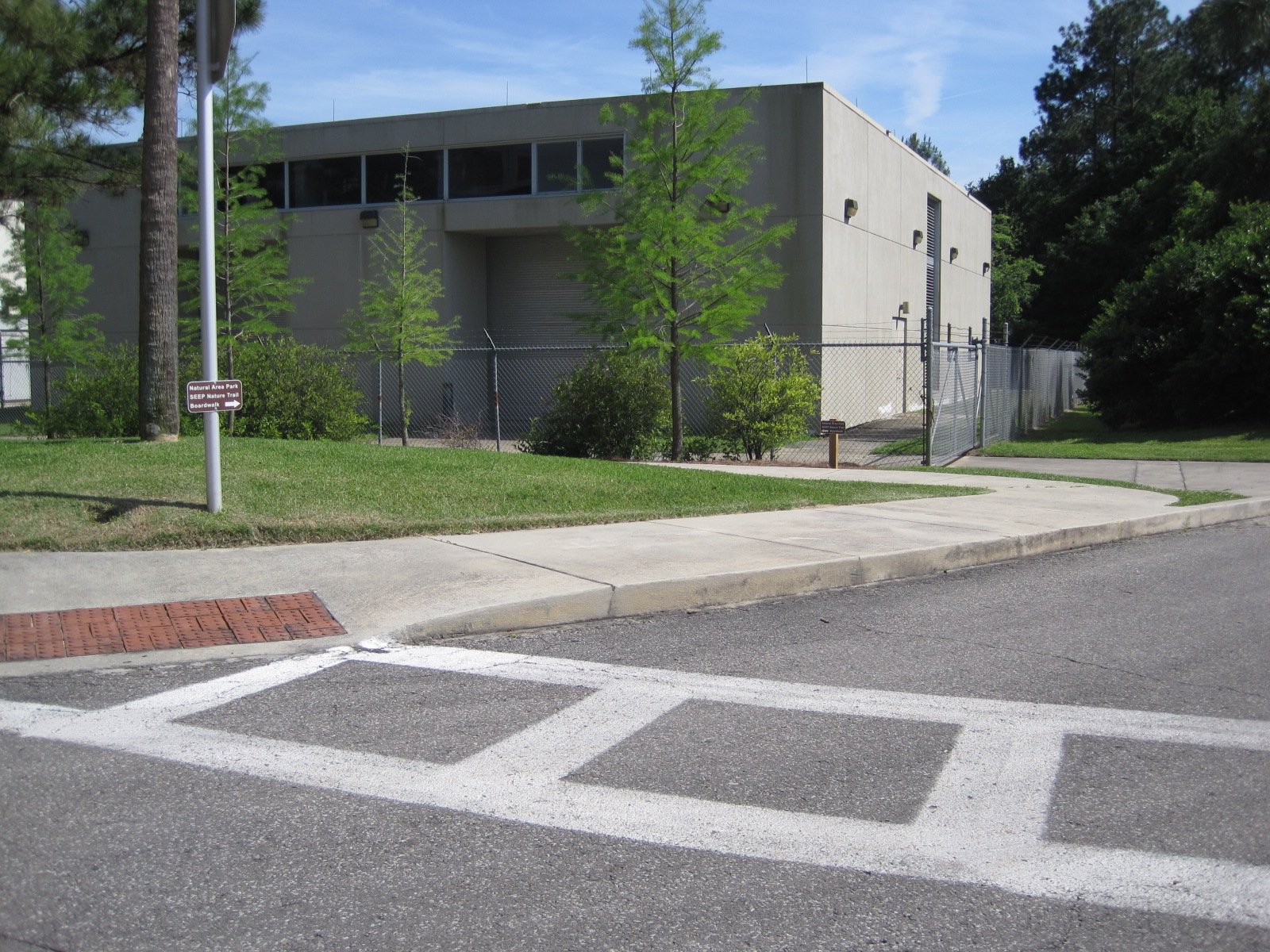
33. New wayfinding signs (2010) NATL signs were originally green-and-white, reflective, parking-lot-type signs (see enhancements Nos. 6 and 17 above). These were swapped out for brown-and-white, non-reflective signs, and new wayfinding signs were designed and installed to guide persons from a Cultural Plaza crosswalk to the sidewalk leading to Natural Area Park, the SEEP Nature Trail, and its boardwalk. |
 |
34. Printed guides to nature trails replaced (2011) When NATL's upland nature trails were completed in 2007, a bin on each kiosk offered a printed trail guide keyed to numbered stakes along the trails. Later both advanced and basic trail guides were offered. These guides have now been made obsolete by interpretive signs along the trails. [However, printed academic guides, for those with academic interests, are now offered on the Upland Pine Trail and are in preparation for the Old Field and Hammock Trails.] |
![]()