Photographic records of restoration of NATL's upland pine ecosystem
Winter photos: 1997, (2004), 2007, 2010-date. Summer photos: 2009-date.
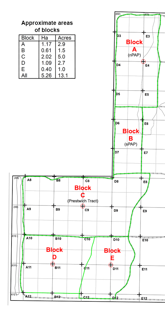 NATL's tracts of upland pine. Gridpoints from which photos were made are ringed with red. |
|
History
The earliest photographs of NATL's upland pine were those taken in January 1997 as part of a photographic record of NATL vegetation. The record was made by taking photographs in each of the four cardinal directions from each gridpoint in NATL's 50x50m grid. Some 31 of these gridpoints are within or on the border of the tracts of upland pine designated for restoration (see map above). In February 2007, to continue the record of NATL vegetation, four photographs were again taken from each gridpoint. Except for photographs taken from gridpoint E4 in April 2004, March 2007, and January 2009, no attempt was made to take gridpoint photos of restoration progress more frequently until July 2009. At that time, a program was begun to make photographs from a grid stake in four representative tracts every January and July. Stakes selected were E4, C9, B11, and D11 (see map). All photographs taken from these stakes can be accessed by clicking the links in the table above.
Methods
During the early occasions of making photographs in four directions from gridpoints, significant changes in the field of view occurred because of changes in cameras and lens:
| Date | Camera | Lens | Field of view |
| January 1997 | Single lens reflex (film) | 50mm | medium wide |
| April 2004 | Canon Powershot (digital) | ?? | wide |
| Jan to Mar 2007 | Canon EOS 20D (digital) | 50mm | narrow |
| July 2009 and later | Canon EOS 20D (digital) | 35mm | medium |
Other aspects of the methods have remained as those described in detail elsewhere.