| UF Academic Use | Public Use | Family Fun and K-12 Education |

Wetlands Photo Gallery
This gallery has three sections: SEEP, NATL-east's central marsh, and Other wetlands.
SEEP - (UF Wetlands Club's Stormwater Ecological Enhancement Project)
Poster describing SEEP.
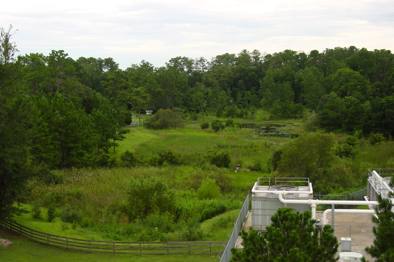 |
SEEP, from north Foreground: (left) Natural Area Park's fence and SEEP's water-treatment forebay; (right) SW chiller plant. Midground: (left) cattail marsh; (right) cypress . Farther: Tree island and open water. [August 2002, from top of parking garage.] |
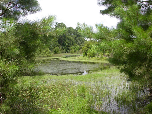 |
SEEP, from south The open water in foreground is the deepest portion of SEEP. To the right of the open water is the tree island that may host a rookery in the future. Beyond the open water is shallow water with cypress trees and beyond that is the berm that defines the "forebay," into which most of the polluted stormwater drains and is somewhat purified prior to making its way into the other communities of SEEP. [July 2004] |
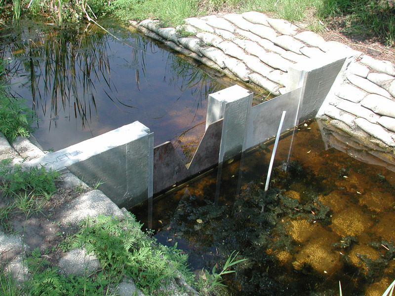 |
Weir at the outflow of the forebay The weir was constructed by the Wetlands Club with help from UF's Physical Plant Division in spring 2006. Its purpose is to control flow and water levels within SEEP. The weir features interchangeable control structures that can be modified and replaced to achieve desired flow into SEEP. The weir's design may aid in future research projects at SEEP. |
 |
Basin prior to re-contouring, from south Prior to re-contouring, NATL’s retention basin was uniformly shallow and on it’s way to hosting a uniform, dense stand of cattails. [September 1996] |
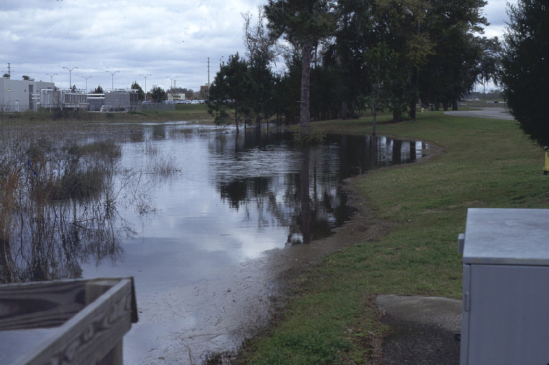 |
Retention basin at highest level During times of high rainfall the basin, which has a bottom of impervious clay, overflows into more porous areas to the west, and water comes closer to Natural Area Drive. [View from southeast end of basin, 24 February 1998.] |
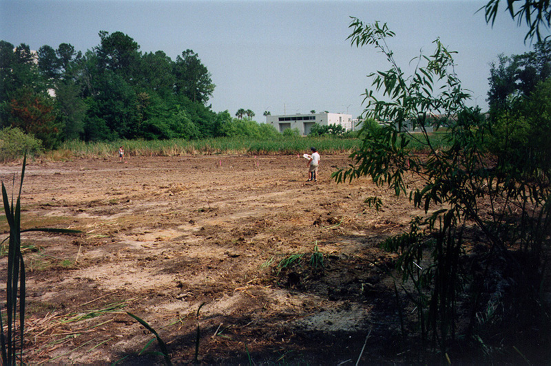 |
Re-contouring begins In May 1998, after a two-month drought, the basin was completely dry, an ideal time for re-contouring the basin according to SEEP specifications. Prior to excavation and filling, most of the cattails had to be removed. [15 May 1998.] |
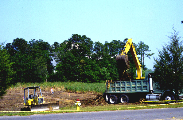 |
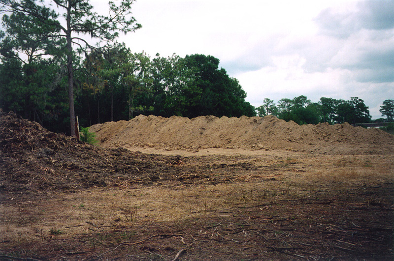
Making basin deeper Some 3000 cubic yards of clay were permanently removed from the basin during re-contouring. [View from Natural Area Drive, 15 May 1998.] |
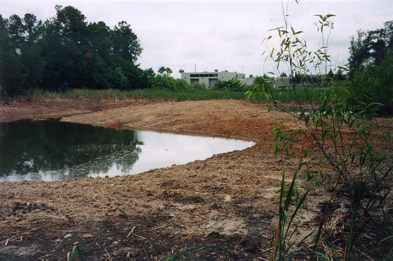 |
Basin fills The drought was broken soon after re-contouring was completed, and the basin began to fill. [South end of SEEP, 28 May 1998.] |
 |
Spoil stored for future use Cattail muck (left foreground) and clay (background) from the re-contouring were temporarily stored on successional Plot C. The muck was later spread on portions of successional plots whose soil, in the 1950’s, had been covered with clay excavated from the site of UF’s Health Center. The clay was used to construct a berm along SW 34th Street. |
NATL-east's central marsh
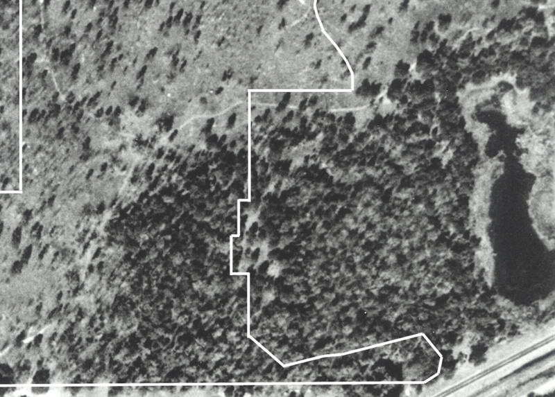 |
1949 aerial photo This photograph, taken 11 February 1949, shows that the central marsh was once an oligotrophic lake (extreme right). Little vegetation is apparent around the lake and none within the lake. The white lines on the left of the photograph indicate the boundaries of NATL prior to its 2005 expansion. |
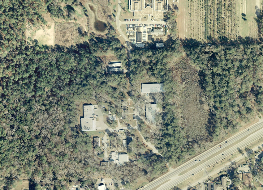 |
2000 aerial photo This photograph shows that by 2000 the lake (center right) had become a eutrophic marsh. What was once open water now appears fully vegetated. The transition was presumably brought about by nutrients and sediments carried by stormwater from surrounding agricultural and urban development. |
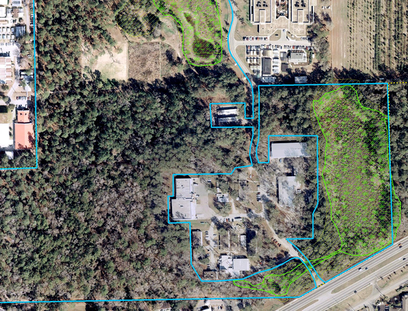 |
Wetlands mapped Superimposed on this 2000 aerial photo are NATL's boundaries (blue) and the limits of wetlands (green) and the 100-year-flood (dim orange) as mapped by Causseaux and Ellington in about 1980 at the 79.8-ft contour. |
 |
Edge of marsh In many places a dense band of royal fern marks the edge of the central marsh. |
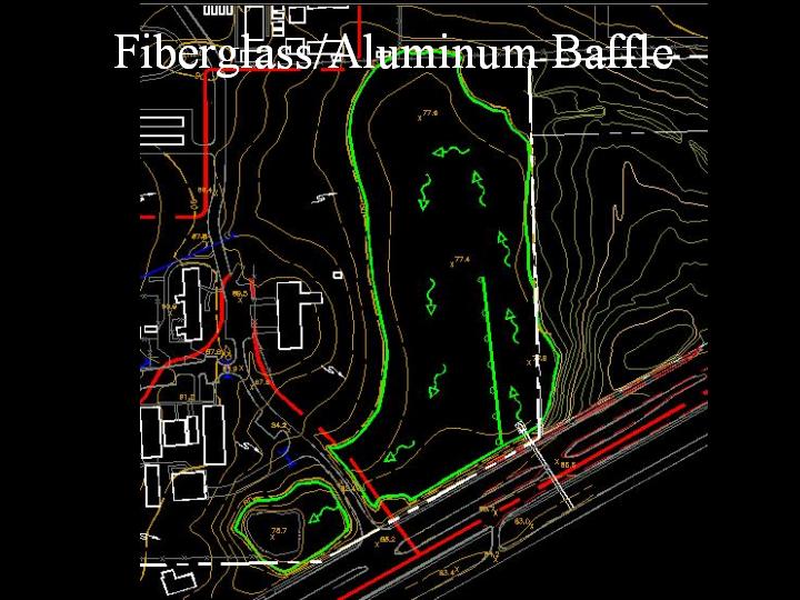 |
Water quality issue Overflow from the central-marsh depression drains into the Florida aquifer via a sinkhole in NATL-west. Substantial stormwater enters the depression from Archer Road and developed areas to the south and from Emmer Development land to the east. Part of a proposal to improve the quality of water leaving the central marsh is to construct a barrier to make the stormwater take a longer, cleansing route to the sink. [illustration and proposal from the 12 Jan 2004 LVL meeting] |
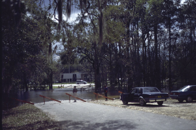 |
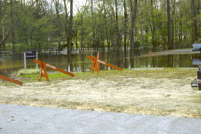
Surge Area Drive flooded in 1998 When rains are heavy, the sinkhole in NATL-west may fail to keep up with draining into the aquifer the stormwaters that it receives. In unusual cases, the resulting flooding may close Surge Area Drive for several days. [View south to Archer Road, 24 February 1998. Microfabritech sign can be seen through windshield of car parked next to road.] |
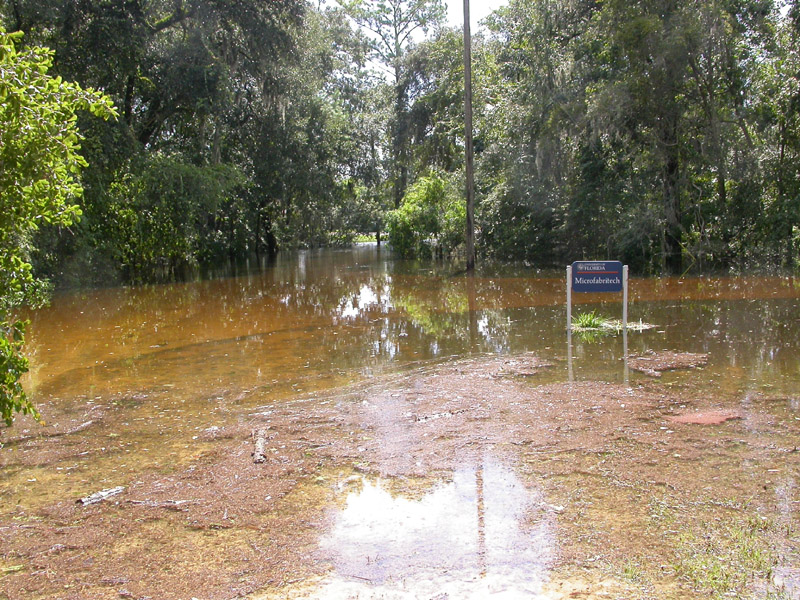 |
Surge Area Drive flooded in 2004 When Hurricane Frances dumped 12.2 inches of rain on NATL, the water rose appreciably higher than in 1998. [View south to Archer Road, 8 September 2004.] |
Other Wetlands
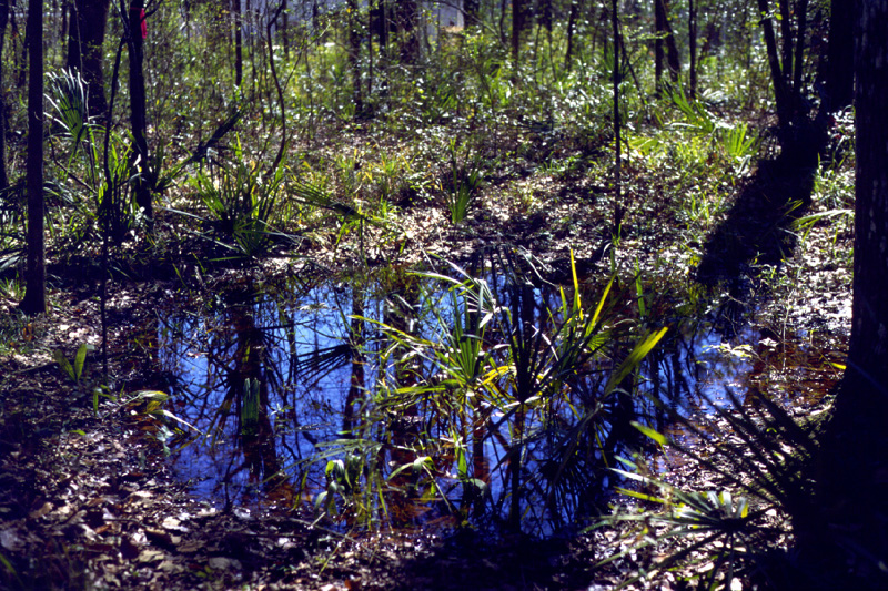 |
Temporary pools During times of heavy rains, depressions in the hammock in the low-use area fill with water and provide temporary pools used by certain frogs and salamanders for breeding. [31 January 1998.] |
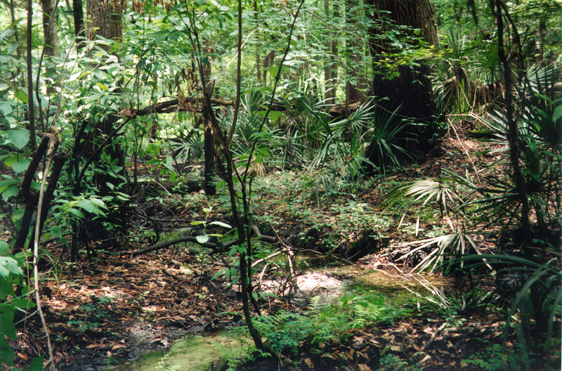 |
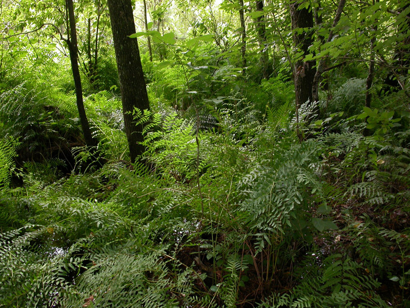
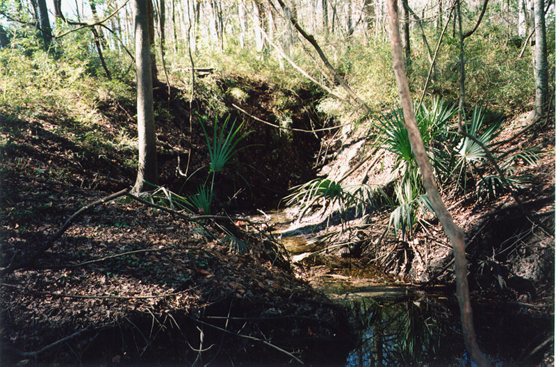
Riparian wetlands Wetlands along rivers and streams are termed riparian. A small stream in NATL-west originates in the NATL-east wetland (see NATL-east's central marsh). This view is of the hardwoods along that stream. [15 May 1998.] |
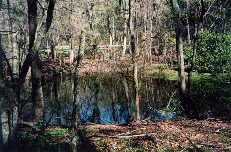 |
NATL’s sinkhole pond The stream runs into NATL’s Sinkhole Pond, a near-permanent pond between Archer Road and the Surge Area. [View from Surge Area southward across Sinkhole Pond, 14 February 1998.] |
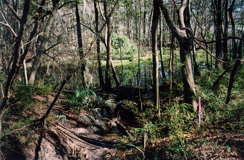 |
Sinkhole Pond outlet Excess water from Sinkhole Pond, in background, drains westward along this channel into a sinkhole. [View from the sinkhole, 14 February 1998.] |
 |
Sinkhole This sinkhole receives the water from Sinkhole Pond. [View westward from near the west edge of Sinkhole Pond, 14 February 1998.] |
 |
Sinkhole pond at max When water enters the sinkhole pond faster than the sinkhole can drain it into the aquifer, the level of Sinkhole Pond rises and may flood Surge Area Drive . [View south from Surge Area, 24 February 1998.] |