History and Starting Dates of Old-Field Plots
Starts, re-starts, and planned re-starts
In the two columns below are the years and months of the starts and re-starts of the five old-field plots, followed [in brackets] by the current plans for future re-starts.
| 2002 (Mar) | 2001 (Nov) |
| 2012 (Dec) | 2003 (Apr) |
| [2021 (Aug begin preparation)] | 2005 (Jan) |
| [2022 (Nov/Dec re-start)] | 2006 (Nov) |
| 2009 (Sep) | |
| Plot D (10-year) | 2011 (Nov) |
| 1997 (Feb) | 2013 (Oct) |
| 2007 (Dec) | 2014 (Oct) |
| [2016 (Aug begin preparation)] | [2016 (Spr)] |
| [2017 (Nov/Dec re-start)] |
|
| [2019 (Spr)] | |
| Plot C (40-year) | |
| 2000 (Nov) | Plot Bsw (1-3 years) |
| 2001 (Nov) | |
| [2040 (re-start)] | 2003 (Apr) |
| 2005 (Jan) | |
| Plot E (40-year) | 2008 (Oct) |
| [2015 (begin preparation)] | 2010 (Nov) |
| [2020 (re-start)] | 2012 (Sep) |
| 2015 (Feb) | |
| [2016 (Fall)] | |
| [2018 (Spr)] | |
| [2019 (Fall)] |
Pre-NATL history
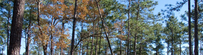
Early aerial photographs of the land that is now NATL suggest that it was fenced and grazed prior to becoming part of UF's Experiment Station Farm in 1944. The area of the present old-field plots had some large longleaf pines and lots of scrubby turkey oaks. What is known of its history from 1950 until 1990 is reconstructed from an interview in which the retired supervisor of the Experiment Station Farm interprets a series of aerial photographs. Of special importance is that, beginning in about 1956 and continuing through 1974, large amounts of clay excavated from the Shands Health Center site were spread on what are now old-field Plots B, C, D, and E.
Defining the plots
1993 map
In the original proposal for a Campus Natural Area and Outdoor Teaching Laboratory, the entire area north of the Main Trail was to be managed to permanently display a diversity of stages of old-field succession.
1995 map
The Natural Area Advisory Committee [NAAC] decided that the western part of the originally designated area should be restored as upland pine and that a corridor from the retention basin to the hammock ecosystem should be allowed to permanently revert to hammock to facilitate wildlife movement between the two habitats.
1997 map
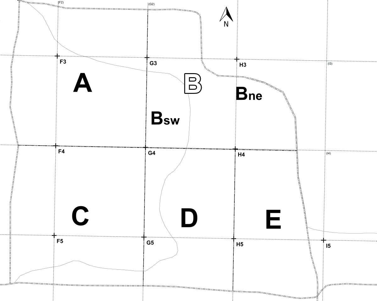
In October 1997, NAAC voted to further modify the plan for the area by enlarging the portion devoted to upland pine and reducing the pond-to-hammock wildlife corridor. It approved boundaries for five old-field plots, named them A, B, C, D, and E, and established a plan for managing them.
2000 map
In April 1999, NAAC reduced the eastward extent of plot E to allow for a mowed academic assembly area and eliminated the pond-to-hammock wildlife corridor. (The corridor seemed unnecessary in view of the 40-year rotation planned for plot E and the discovery that previous maps had omitted a southward enlargement of the retention basin made necessary by the construction of the Performing Arts Center.) In November 2000, NAAC voted to shift the boundary between plots D and E westward to the H gridline. Except for the exact placement of the east boundary of Plot E, this established the boundaries of the plots as they are mapped today.
2008 map
When the route of the Old Field Nature Trail was established in the fall of 2006, it became apparent that the portions of plot B that were east and west of the trail should be restarted at different times in order to display a larger variety of early successional stages along the trail. Thus in November 2006, the portion of plot B east of the trail was restarted; in December 2007, plot D was started on its second 10-year rotation; and in October 2008, the portion of plot B west of the trail was restarted. In 2008, the east boundary of plot E was set about 50 ft west of the pavilion.
2014 map 1; 2014 map 2
The current maps that define the old-field plots differ from the previous ones in that they use NATL's GIS map to define both the boundaries of NATL's Old-Field Ecosystem and its constituent plots.