| UF Academic Use | Public Use | Family Fun and K-12 Education |

Aerial Photographs
 |
2000 Old Field Plot C (lower left of group of four old-field plots immediately south of the Phillips Center) was started on its first 40-year rotation by double disking on 28 Nov 2000. |
 |
2006 Old Field Plot B (upper right of group of four plots immediately south of the Phillips Center) was mowed and disked on 6 Nov 2006. |
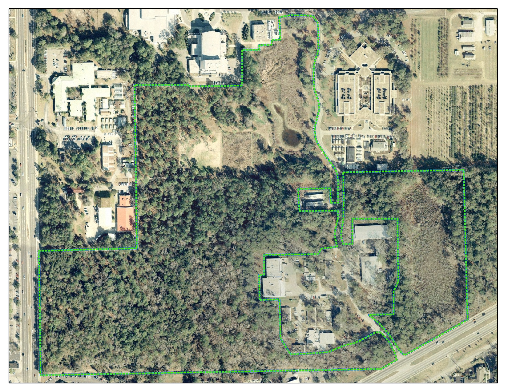
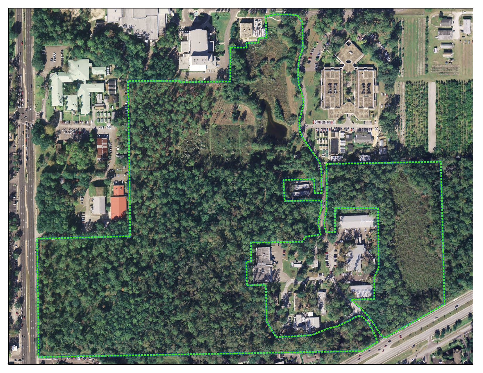
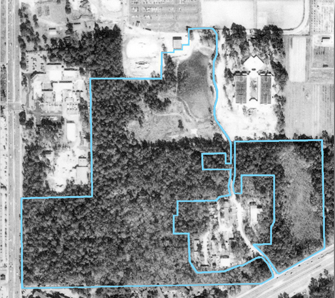
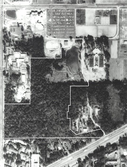
The three black-and-white aerial photographs below show the area that now encompasses NATL. On each photo, the present boundaries of NATL-west and NATL-east are outlined in blue. Archer Road cuts diagonally across the lower right corner.
 |
11 Feb 1949 This picture was taken soon after UF acquired the land. Hammock occupies the southeastern portion of what will become NATL-west. The rest of that area has no large-crowned trees but numerous longleaf pines of modest size with an understory of scrubby turkey oaks. |
 |
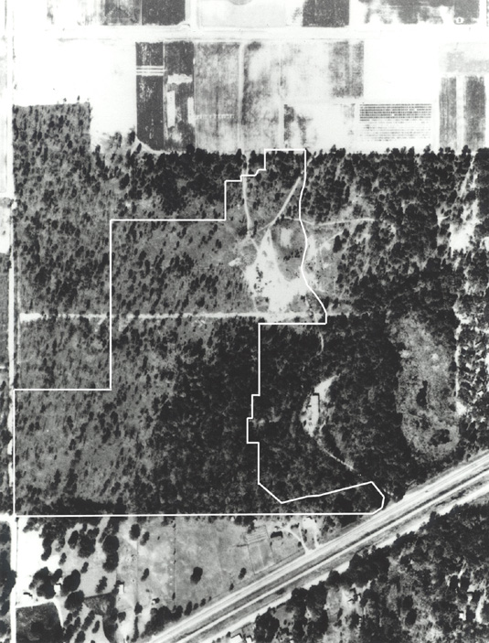
4 Feb 1974 By 1974, the Florida Department of Agriculture had acquired 10 acres on SW 34th Street and built most of its Division of Plant Industry complex, including the Doyle Conner Building. Much of what is to become old-field successional plots has been used to dump clay excavated from sites of Medical Center buildings, and the development of the Surge Area (betweein NATL-w and NATL-e) has begun. |
 |
1 Jan 1990 By 1990, laurel oaks form a continuous canopy in the undisturbed (and unburned) upland pine areas, shading out the turkey oaks and curtailing reproduction of longleaf pines. Immediately north of the future NATL, the Performing Arts Center is under construction and the Entomology and Nematology Building is nearly complete. The DPI complex has expanded onto 5 acres to the south of its original 10 acres. |
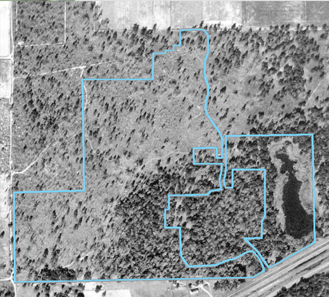
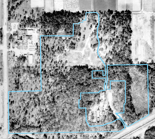
Each of the black-and-white aerial photographs below shows an area with Hull Road at the top (= North) and SW 34th Street on the left. Archer Road cuts diagonally across the lower right corner. Except in the 1937 photo, a white outline shows the area of the original NATL-west.
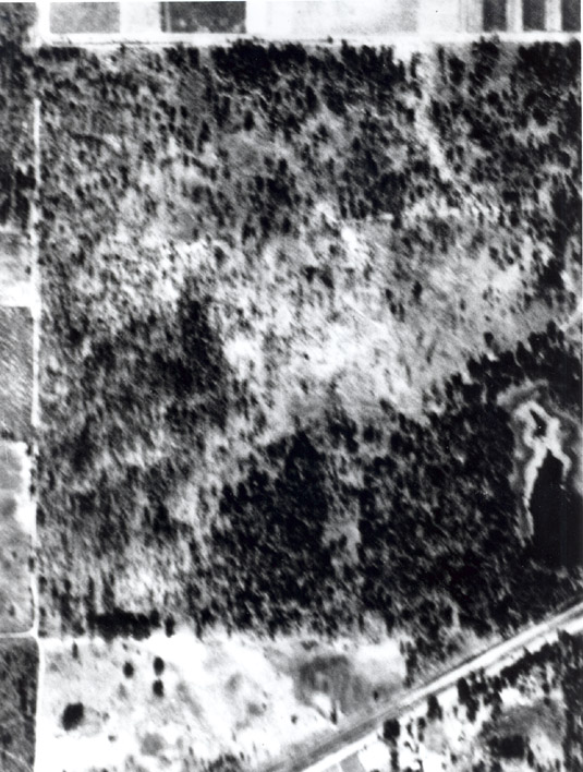 |
20 Dec 1937 This, the earliest aerial photograph of NATL, is in poor focus but trees with large crowns are evident in the areas that are now upland pine and old fields. These trees are not evident in the 1949 photograph, which agrees with a conclusion in a 2005 study of the ages of NATL's longleaf pines--namely that in about 1940 the longleaf pines of marketable size were harvested from the area that would become NATL. |
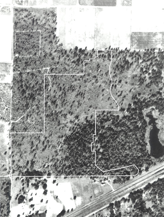 |
11 Feb 1949 This picture was taken soon after UF acquired the land. As in the 1937 picture, hammock occupies the southeastern portion of what will become NATL-west. The rest of the area has no large-crowned trees but numerous longleaf pines of modest size with an understory of scrubby turkey oaks. |
 |
11 Feb 1961 By 1961, the University had begun to use the northeastern part of the future NATL as a place to spread clay excavated from construction sites. To the southeast, the University had begun to develop the Surge Area, where economical buildings that housed research projects could overflow (“surge”) from the main campus. |
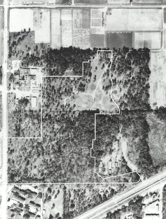 |
4 Feb 1974 By 1974, the Florida Department of Agriculture had acquired 10 acres on SW 34th Street and built most of its Division of Plant Industry complex, including the Doyle Conner Building. |
 |
1 Jan 1990 By 1990, laurel oaks formed a continuous canopy in the undisturbed (and unburned) pineland, shading out the turkey oaks and curtailing reproduction of longleaf pines. The Performing Arts Center was under construction just north of the future NATL, and, to the east, the Entomology and Nematology Building was nearly complete. The DPI complex had expanded onto 5 acres to the south of its original 10 acres. |
Note: An interview about the post-WWII history of NATL's site has a larger set of early aerial photographs explained in greater detail.