| UF Academic Use | Public Use | Family Fun and K-12 Education |
Maps of NATL's Pines
In 2008, to enable monitoring of future growth and mortality of NATL's mature pines, Robert Guggenheim and Tom Walker began a project to measure and map all pines that were believed to have been present when NATL was founded in 1994. Earlier projects and methods of the current work are described at the bottom of this page. On the basis of land use, the maps are in three sets in NATL-west. NATL-east has a single set. [Guggenheim and Walker began, but did not finish, a project to map NATL-east's hardwoods.]
NATLwest, Upland Pine (two master maps with access to >50 maps)
NATLwest, Old field plots and vicinity of SEEP (master map with access to 32 maps)
NATLwest, Hammock ecosystem (master map with access to 32 maps)
NATLeast (master map with access to 8 maps)
Current Maps of Pines in NATL's Upland Pine Ecosystem
Archive of earlier maps (with earlier master map)
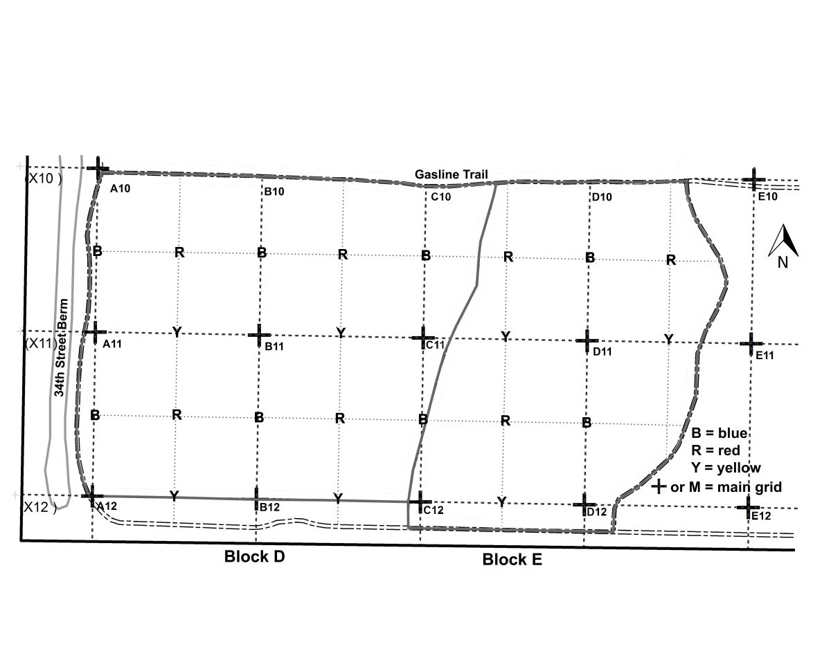
When NATL was established in 1994, none of it had burned in more than 50 years. As a result, there were no young longleaf pines in the more than 15 acres dominated by mature longleaf pines. NATL's planning and management committee (NAAC) designated 13 of these acres to be restored to a healthy upland pine ecosystem. Restoration started in 1995 in NATL's public area and soon expanded to include similar habitat in NATL's restricted area. As restoration progressed, mature longleafs died and initially no record was made of their loss or its causes. In some cases the cause seemed clear (blown down, struck by lightning, too much duff burned around base) but in many cases it did not. For example, in September 2004, winds from hurricanes Francis and Jeanne felled only two longleaf pines in the resticted area, but in 2006, after a severely dry spring, several times that many died. Most of these were in Block D and the western portion of Block C. This mortality is believed to have been from mechanical damage to the roots during wind-induced motion of the trunks in the September 2004 hurricanes.
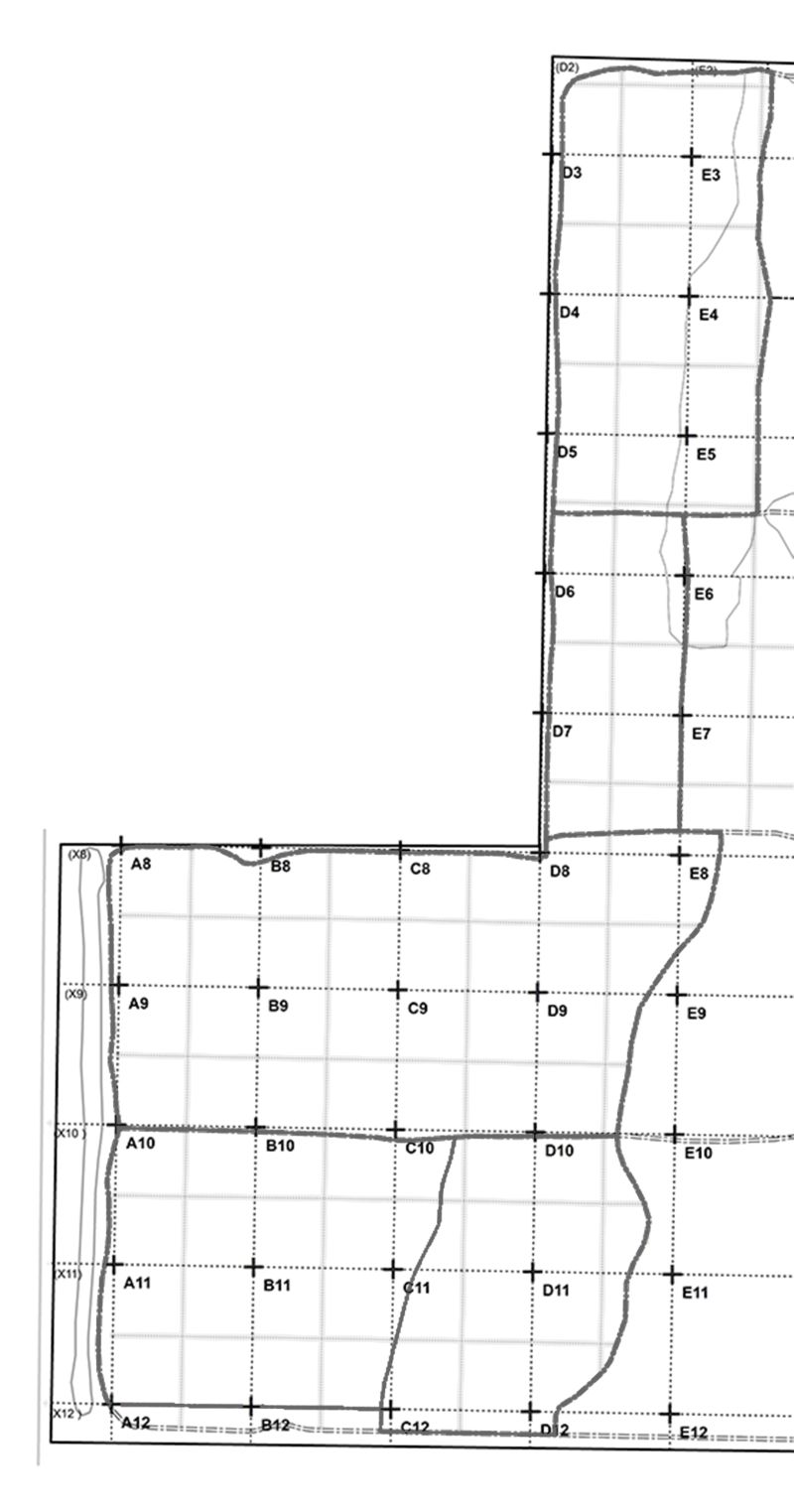
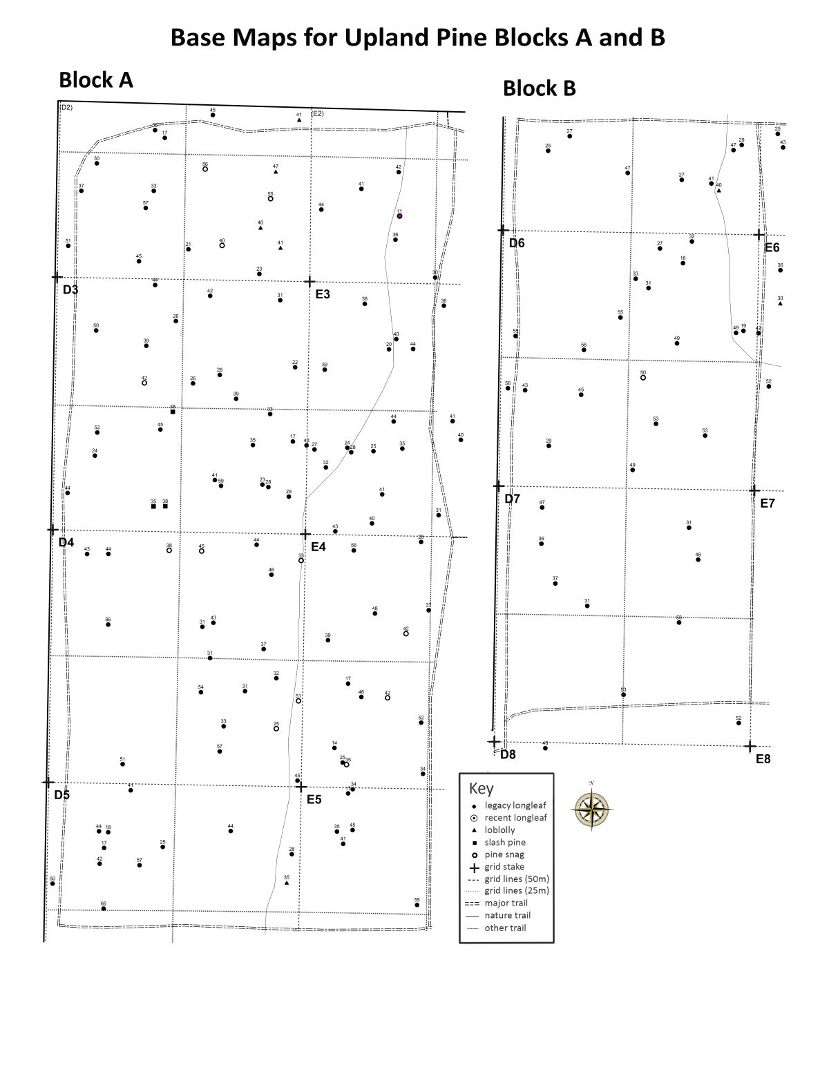
The 10 most useful maps of the five blocks of NATL's Upland Pine ecosystem are made easily accessible below. Every map displays NATL's 50x50 grid system, and each 50x50 gridblock is divided into four 25x25 "1/4-gridblocks." (On the ground, the corners of all gridblocks are marked with stakes.) Five of the 10 maps are "diameter maps." These show the positions of all pines in the block that are 10cm or more in diameter at breast-height [DBH]. For each pine mapped, the diameter, species, and condition (live or snag), are made evident. The other five of the most useful maps are "P-number" maps. These give access to important data for any mapped NATL pine in a GIS-based spreadsheet. The geographic coordinates of all 50x50m grid stakes are in a second online spreadsheet. Both these and the calculated coordinates for the 25x25m grid stakes are in NATL's GIS
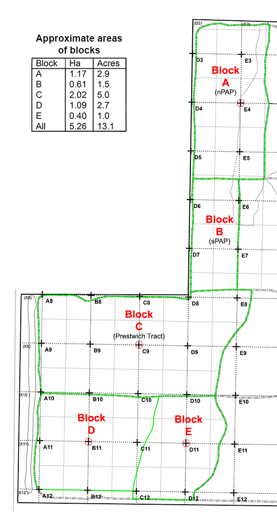 |
Ten most useful maps The PDF files of the ten maps may be downloaded by clicking the appropriate cell in the table below. The diameter maps can be viewed and printed by clicking on the appropriate UP block in the map at left. As already explained above, P-number maps provide a unique identifier for each pine tree to allow access to important data for any mapped NATL pine in this GIS-based spreadsheet.
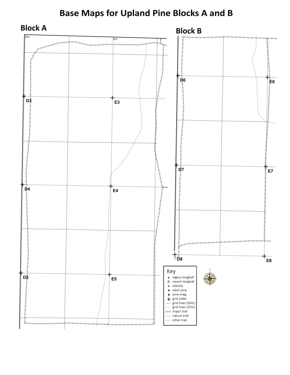
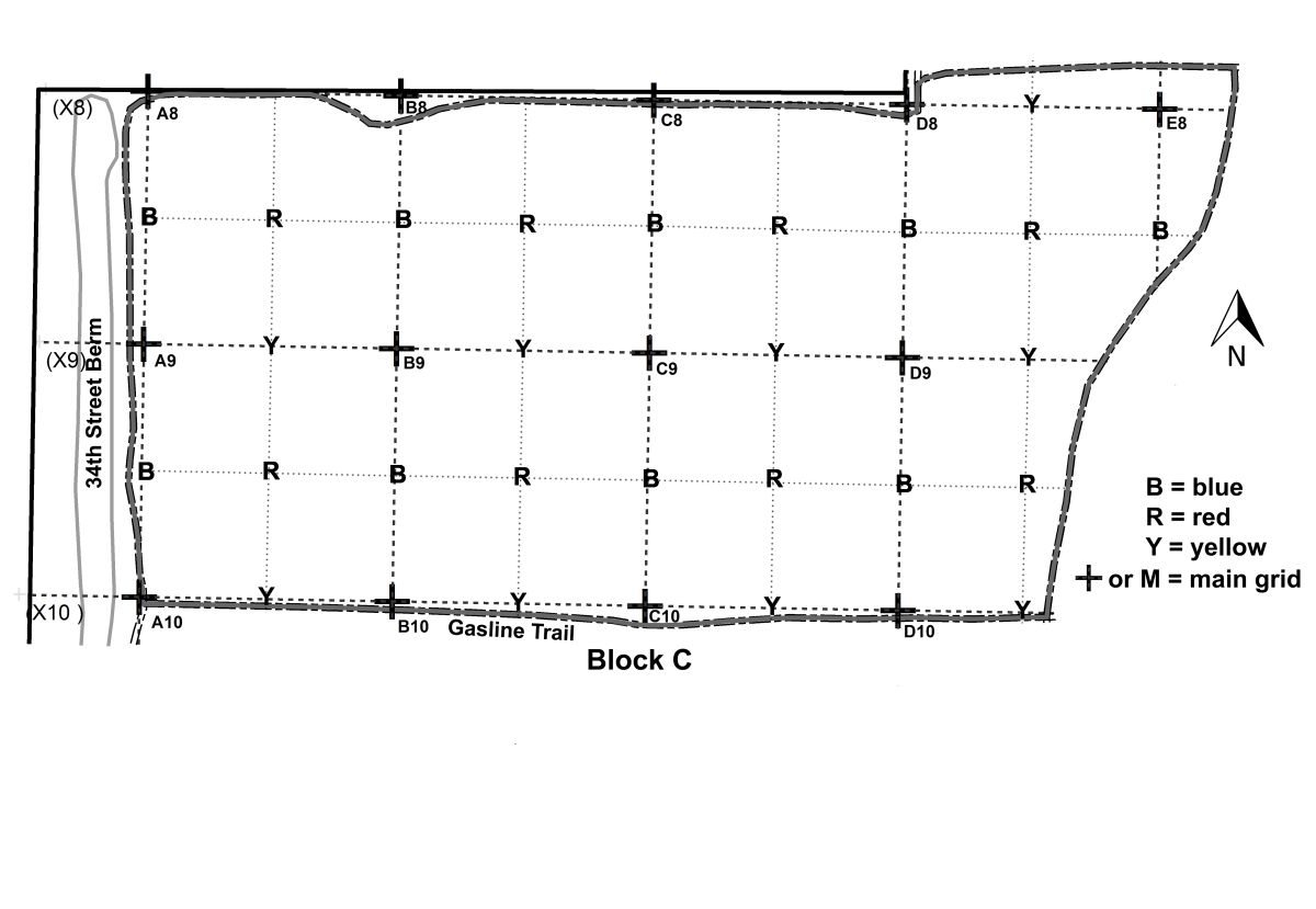
Additional maps of UP blocks All blocks with gridlines Base map of A and B (with pines and diameters) Base map of A and B (no pines or diameters) Outline map of Block C Outline map of Blocks D and E Restoration islands (Blocks A & B, 2005) These 48 small areas (“islands”) were given special treatment during the early years of restoring Blocks A & B. The effects of the special treatment of these islands are still quite evident. Pine map archive As the maps of NATL pines are updated, earlier versions are moved to a map archive. This will facilitate following the life histories of all the trees from the year of first mapping to the crashing of its snag. For the time being the archive will have only the 2008 maps of blocks and sub-blocks of Upland Pine ecosystem. A way to begin is to make all the maps originally accessible at what you moved in part to “Earlier Maps of Pines in NATL’s Upland Pine Ecosystem.” |
Excel spreadsheets
The spreadsheet GISpines.xls has the same data as the .dbf file of the Pines layer of NATL's ArcGIS map. This includes a record for each pine, with its P-number, NATL tract and grid square, UTM coordinates, diameter in cm, date of measurement, and notes (including changes since 2008). Another spreadsheet, PineSummary.xls, summarizes the pine mapping project by tract.
Note: To convert UTM coordinates to latitude and longitude, you need to know that the UMT system used was NAD 1983 UTM ZONE 17N and have access to appropriate software. That software is conveniently available at http://www.rcn.montana.edu/resources/tools/coordinates.aspx. Simply make sure the Hemisphere is "North Lat", and fill in the values for Zone [17], Easting [x values] and Northing [y values].
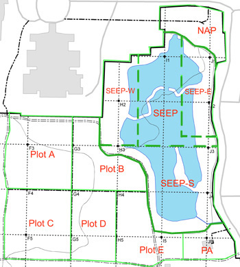
Maps of Pines in NATL's Old-field Plots and SEEP and Vicinity
When old-field plots were established in NATL, the Natural Area Advisory Committee decided that all trees except mature longleaf pines would be cut each time the plots were restarted. This exception was made in order to increase the genetic diversity of longleaf pollen available to the upland pine ecosystem. SEEP includes an ecologically engineered wetland and surrounding uplands that are included in its management area. Within SEEP, a tree island and a cross-SEEP berm are well populated with loblolly pines but none pre-date NATL. Island and berm were created during the basin's recontouring in 1998, and all the pines arrived as wind-blown seed. North of SEEP is Natural Area Park (NAP) and south of it is a pavilion area (PA) that serves as a staging area and outdoor classroom.
| < |
Diameter Maps A diameter map of pines shows their species, diameter-breast-high in cm, and location. To download a diameter map for any of the eight tracts on the map at left, click on the tract of interest (outlined in green and labeled in red). P-number Maps "P numbers" provide a unique identifier for each pine tree and facilitate access to other data for all pines that are part of the Pines layer of the NATL GIS map. To download a P-number map for a tract, select the appropriate link below. Old-field Plots A and B Old-field Plots C and D Old-field Plot E Natural Area Park SEEP west SEEP east SEEP south Pavilion Area |
Excel spreadsheets
The spreadsheet GISpines.xls has the same data as the .dbf file of the Pines layer of NATL's ArcGIS map. This includes a record for each pine, with its P-number, NATL tract and grid square, UTM coordinates, diameter in cm, date of measurement, notes, and changes since 2008. Another spreadsheet, PineSummary.xls, summarizes the pine mapping project by tract.
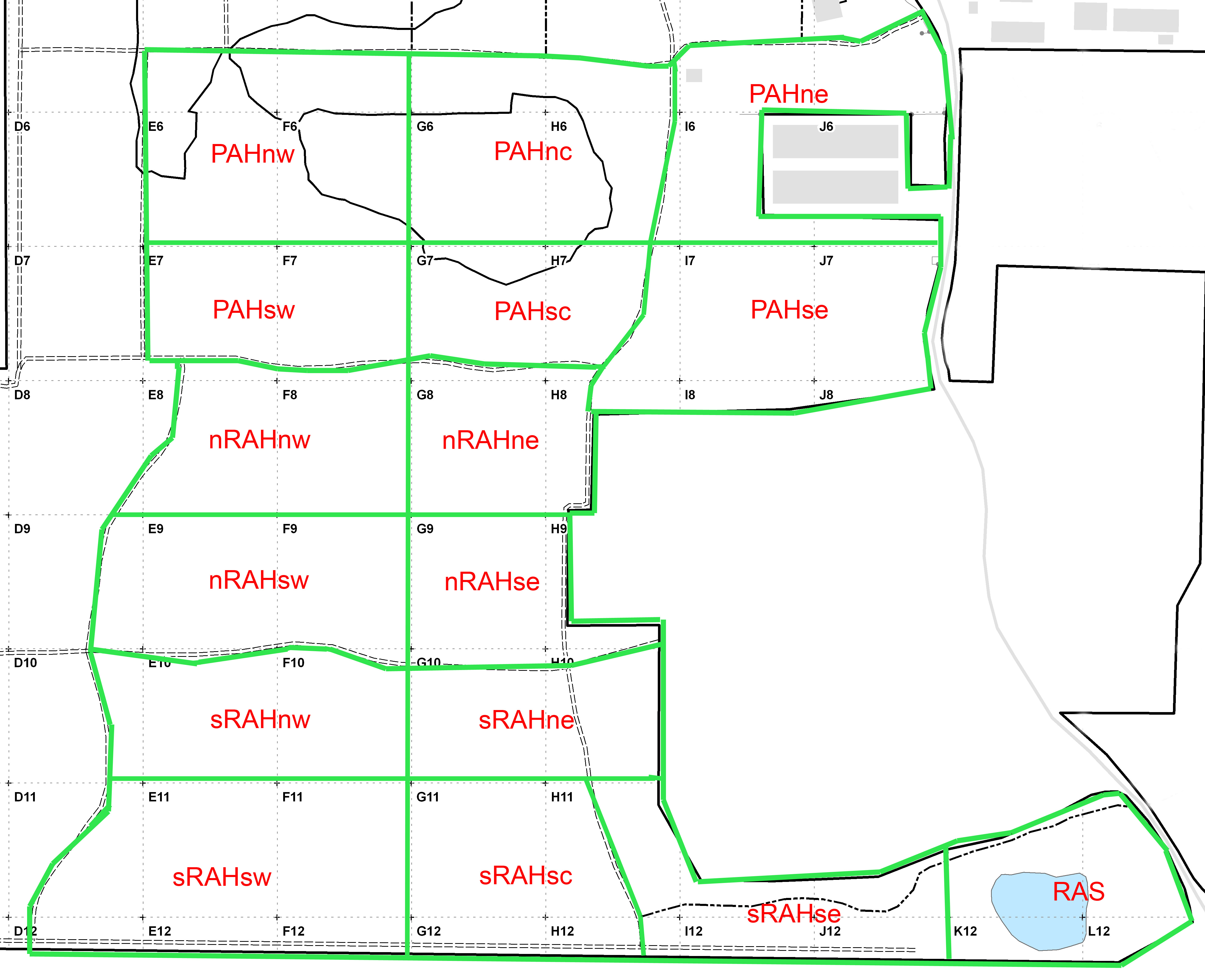
Maps of pines in NATL-west's hammock ecosystem
Nearly all the pines in the hammock ecosystem are loblollies. When NATL was established in 1994, the pines in the southern half of the hammock were scattered and large, suggesting that they had become established many years ago, perhaps in temporary breaks in the canopy caused by scattered mature broadleaved trees dying of disease or windfall. On the other hand, the pines in the northern half of the hammock were dense enough to form a canopy and of an age and size to indicate that they had become established in an old field in the early 1940's. A southern pine beetle outbreak in 2001 killed a majority of these pines and ended or reduced shade tolerance being of advantage in the understory.
Excel spreadsheets
The spreadsheet GISpines.xls has the same data as the .dbf file of the Pines layer of NATL's ArcGIS map. This includes a record for each pine, with its P-number, NATL tract and grid square, UTM coordinates, diameter in cm, date of measurement, notes, and changes since 2008. Another spreadsheet, PineSummary.xls, summarizes the pine mapping project by tract.
Maps of pines in NATL-east
All pines in NATL-east are loblollies. Aerial photographs going back to 1937 show no disturbance in the wooded portions of NATL-east nor do they refute the notion that the largest loblollies there got their start at the same time as the largest ones in NATL-west. Age determination of selected trees is needed to establish whether a long ago major disturbance started many of NATL's largest loblollies and, if so, the approximate year of the disturbance.
 |
Diameter Maps A diameter map of pines shows their species, diameter-breast-high in cm, and location. To download a diameter map for any of the eight tracts on the map at left, click on the tract of interest (outlined in green and labeled in red). P-number Maps "P numbers" provide a unique identifier for each pine tree and facilitate access to other data for all pines that are part of the Pines layer of the NATL GIS map. To download a P-number map for a tract, select the appropriate link below. northwest NATL-east northeast NATL-east central NATL-east south NATL-east Excel spreadsheets The spreadsheet GISpines.xls has the same data as the .dbf file of the Pines layer of NATL's ArcGIS map. This includes a record for each pine, with its P-number, NATL tract and grid square, UTM coordinates, diameter in cm, date of measurement, notes, and changes since 2008. Another spreadsheet, PineSummary.xls, summarizes the pine mapping project by tract. |
Earlier, relevant work
In 2003, because a four-lane extension of SW 24th Avenue had been proposed for the south extreme of NATL-west, T. J. Walker and his daughter mapped and measured the 95 trees that were 30cm or more DBH and within the proposed 90-foot right-of-way. Among these trees were six longleaf pines (32 to 61 cm DBH) and 11 loblolly pines (34 to 65 cm DBH). The detailed data from the survey were recorded in a spreadsheet.
In 2005, Jeff Morton wrote the final report for his Minigrant project "Historical ecology of UF's Natural Area Teaching Laboratory." In the report he listed nine longleaf pines and nine loblolly pines that he had cored in order to determine their ages. Seventeen of these trees were matched with those mapped in the current project and an addendum prepared and attached to Morton's final report.
Methods
In 2008, as Jason Martin was developing a ArcGIS map of NATL, he worked with Robert Guggenheim (RG) and T. J. Walker (TW) to develop procedures for making the locations of individual pine trees, and related data, a layer in that map.
The procedures finally adopted had these steps:
- 1. Grid lines were cleared and grid points flagged to make it easier to assign any pine to a single grid block. (A pine on a grid line was assigned to the block that seemed to have the larger share.)
- 2. For each designated tract, RG identified each pine and measured its DBH at approximately 130 cm from the base of the tree at dirt level. If the tree had branched into two or more trunks at breast height, the DBH was taken of each trunk of the tree at DBH, and written as, for example, DBH130=30/12/12.
- 3. RG then estimated the pine's location within its grid block by symbols penciled onto a paper map. He also measured and mapped snags of pines (even when they had fallen), but did not attempt to identify them to species.
- 4. The trees (and snags) were assigned unique identifying "P numbers" (e.g., P122) and their coordinates determined with the Trimble GPS unit.
- 5. The coordinates, P numbers, and DBHs were transferred to the Pines layer of NATL's ArcGIS map and preliminary maps printed. Coordinates were not corrected by reference to a base station.
- 6. With the preliminary DBH maps in hand, TW and RG went to the field to determine if every pine in the tract was mapped and correctly identified. When the GPS position of a pine was in significant conflict with its position as observed in the field (e.g., it was on the wrong side of a grid line or not close to a near neighbor), a more appropriate position was noted on the preliminary map.
- 7. RG used GIS software to reposition the misplaced pines and printed drafts of final maps.
- 8. TW made sure that the final maps incorporated the changes agreed upon in the field.
- 9. TW made sure that the final spreadsheet had each listed pine correctly classified as to region, grid square, and species.
Important details of these procedures were recorded in Instructions for Trimble GeoXT GPS unit & ArcGIS.

